Advertisement
If you have a new account but are having problems posting or verifying your account, please email us on hello@boards.ie for help. Thanks :)
Hello all! Please ensure that you are posting a new thread or question in the appropriate forum. The Feedback forum is overwhelmed with questions that are having to be moved elsewhere. If you need help to verify your account contact hello@boards.ie
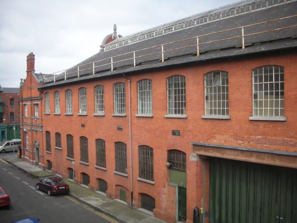
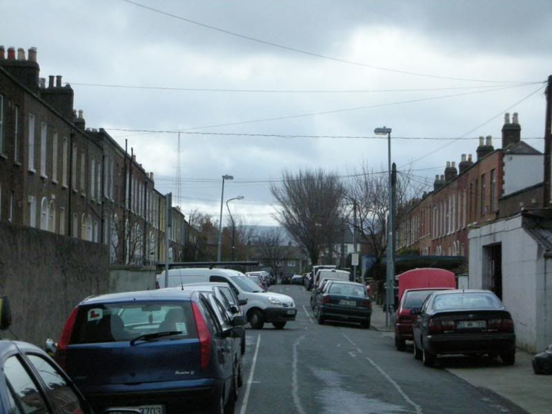
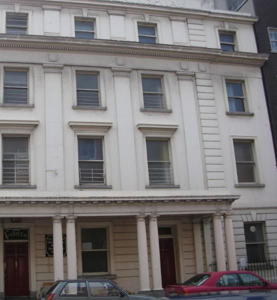
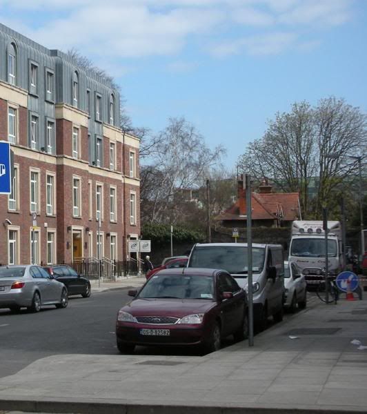
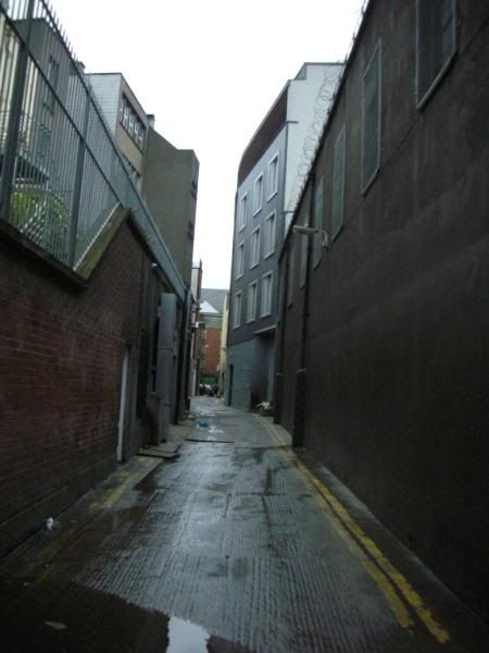
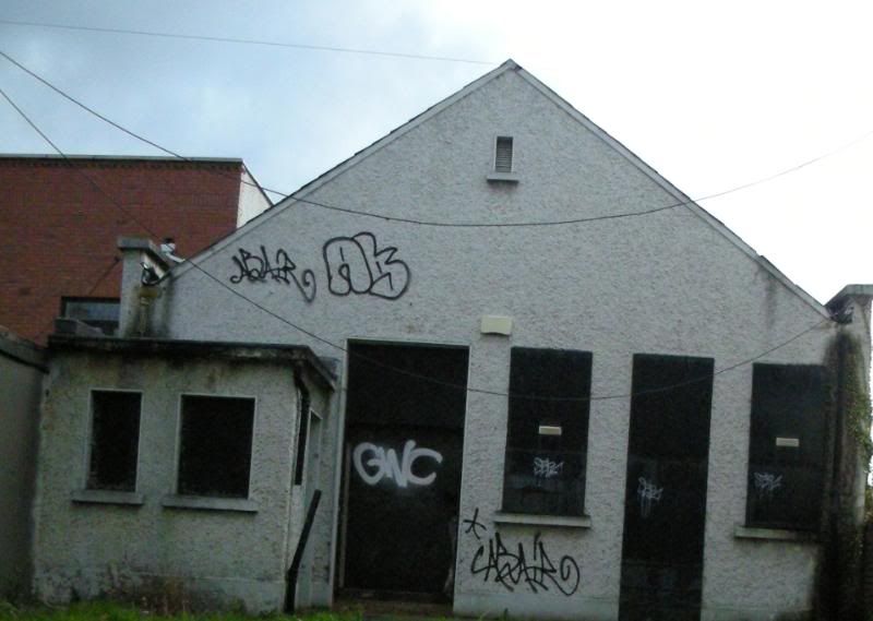
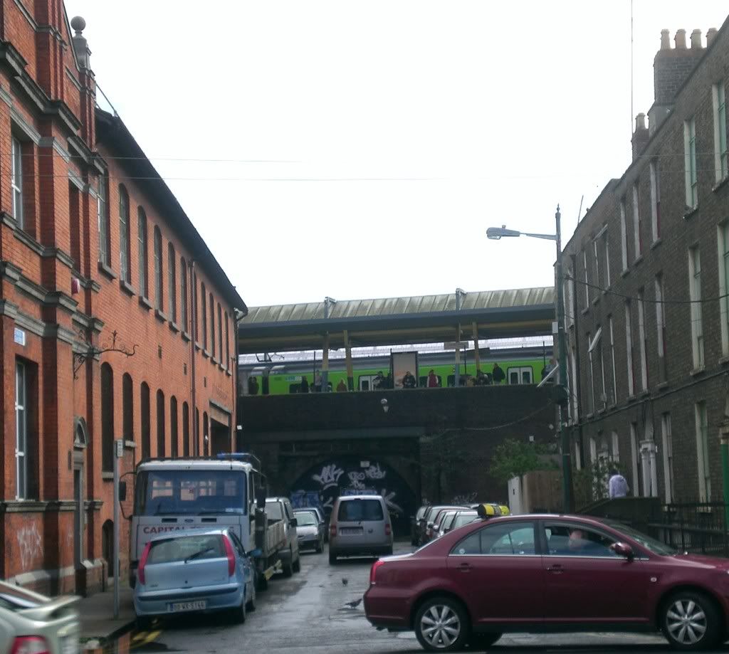
Dublin Picture Game

Options
1131132134136137230

Comments

  • Moderators, Music Moderators Posts: 10,534 Mod ✭✭✭✭humberklog


    DesF wrote: »
    What does that mean?
    Complete guess that Ordinance Survey may have markers in Phoenix Park showing the accepted length of Chainage (How us engineers used to measure things) used in Ireland.


  • Closed Accounts Posts: 41,926 ✭✭✭✭_blank_


    humberklog wrote: »
    Complete guess that Ordinance Survey may have markers in Phoenix Park showing the accepted length of Chainage (How us engineers used to measure things) used in Ireland.

    Well, I'll give it to you, in that I don't know what the hell they are. I took the photos with the intention of coming in here and asking what they were.

    Anyway, starting from the Phoenix Roundabout on Chesterfield Avenue, they appear at regular intervals Even on the right, Odd on the left (iirc) as you walk towards the Parkgate Street entrance, I didn't get any further than 5 though.

    I was there on Sunday and noticed them, and my gf suggested milestones after we saw the first one, but after seeing the other ones, I knew they definitely weren't, and there's no way Chesterfield Ave is 5 miles from the GPO anyway.

    Thanks for the info humberklog.:)


  • Moderators, Music Moderators Posts: 10,534 Mod ✭✭✭✭humberklog


    I could be wrong in what they are. But as I live beside pk I'd noticed them a lot and took it that it was to do with the O.S office. That's been based in the park since late 1700's I think.(waitin for someone to wiki that outta the water). So civil engineers woulda trained there and chainage points coulda been used for training in 'setting-out'. You can also see little 'crows feet'(inverted v with a line across top) around the park (and many older buildings across country). These are datum marks and they'll have a corresponding value to them. This value shows how high above sea level it is at that point.


  • Registered Users Posts: 907 ✭✭✭Rashers


    Ummm... scraping away cobwebs here from the brain about units of measurement I learned about at primary school. If I'm right 10 chains was a furlong, and with 8 furlongs in a mile.... 80 chains was a mile?

    Ohh I have a headache now. :(


  • Registered Users Posts: 327 ✭✭Dlite


    Get a pic up Humberklog!


  • Advertisement
  • Moderators, Music Moderators Posts: 10,534 Mod ✭✭✭✭humberklog


    Rashers wrote: »
    Ummm... scraping away cobwebs here from the brain about units of measurement I learned about at primary school. If I'm right 10 chains was a furlong, and with 8 furlongs in a mile.... 80 chains was a mile?

    Ohh I have a headache now. :(
    Correct indeed rashers, 22 yards make a chain. We still use the word 'chainage' but obviously not the measurement. Thank god for metric.


  • Moderators, Music Moderators Posts: 10,534 Mod ✭✭✭✭humberklog


    Dlite wrote: »
    Get a pic up Humberklog!
    I can't. No digital camera and I don't keep a pc at home. Use in work or cafes.


  • Moderators, Category Moderators, Music Moderators, Regional East Moderators, Regional Midlands Moderators, Regional Midwest Moderators, Regional Abroad Moderators, Regional North Mods, Regional West Moderators, Regional South East Moderators, Regional North East Moderators, Regional North West Moderators, Regional South Moderators Posts: 8,032 CMod ✭✭✭✭Gaspode


    Ok folks, here's a few for you. Apologies if I've poseted any of these before, I've lost track of which ones I had put up.
    1
    DPG057.jpg
    2
    DPG055-1.jpg
    3
    DPG062.jpg
    4
    DPG059.jpg
    5
    DPG058.jpg
    6
    DPG050-1.jpg
    7
    DPG051-1.jpg
    8
    DPG054-1.jpg


  • Closed Accounts Posts: 9,700 ✭✭✭tricky D


    4 looks like earlsfort tce (edit wrong - cars pointing wrong way)
    5 clonmel st off harcourt st


  • Registered Users Posts: 2,808 ✭✭✭Ste.phen


    3 - Dublin Castle?
    4 - Hume st
    5 - Clonmel St (beaten to this one by tricky D)
    7 - Moore Lane?


  • Advertisement
  • Closed Accounts Posts: 15,515 ✭✭✭✭admiralofthefleet


    is number 1 preston street?

    number 5 the iveagh gardens?


  • Registered Users Posts: 2,808 ✭✭✭Ste.phen


    is number 1 preston street?
    I believe you're right on this one, never seen it from that angle before, but it definitely looks like the right building


  • Registered Users Posts: 17,965 ✭✭✭✭Gavin "shels"


    No 2. Longwood Ave
    No.5 Clonmel St leading into the park there.


  • Moderators, Music Moderators Posts: 10,534 Mod ✭✭✭✭humberklog


    8. Is clanbrassil st.
    Is 3. the 4courts?


  • Registered Users Posts: 17,965 ✭✭✭✭Gavin "shels"


    humberklog wrote: »
    8. Is clanbrassil st.


    :mad: Just beat me to it.


  • Moderators, Music Moderators Posts: 10,534 Mod ✭✭✭✭humberklog


    :mad: Just beat me to it.
    Yeah I wassurprised you didn't get there 1st.


  • Registered Users Posts: 78,418 ✭✭✭✭Victor


    1. Preston Street (or is it the one on the other side) from the DART platforms at Connolly.
    2. Bloomfield Avenue, looking at Cathal Brugha Barracks.
    3. Government Buildings
    4. The former City of Dublin Skin and Cancer Hospital in Hume Street
    5. Clonnmel Street, facing the Iveagh Gardaens with the Eqaulity Authority to the left.
    6. St. Mary's Palce North
    7. Bow Lane (East) from Aungier Street
    8. Lower Clanbrassil Street - I think its a band hall.


  • Registered Users Posts: 24,993 ✭✭✭✭Wishbone Ash


    No. 6 is the Church of St Michael and John on Exchange Street Lower.


  • Registered Users Posts: 24,993 ✭✭✭✭Wishbone Ash


    I'll guess the Customs House for no. 3.

    Igy wrote: »
    7 - Moore Lane?
    Moore Lane is much wider - it's used by delivery vehicles. ;)

    It reminds me of that lane between Dame Street and East Essex Street (Crane Lane?) but it just doesn't look right.


  • Registered Users Posts: 78,418 ✭✭✭✭Victor


    It reminds me of that lane between Dame Street and East Essex Street (Crane Lane?) but it just doesn't look right.
    Cobbled, wider and with 'footpaths'.


  • Advertisement
  • Registered Users Posts: 24,993 ✭✭✭✭Wishbone Ash


    Victor wrote: »
    Cobbled, wider and with 'footpaths'.
    No it's a very narrow one just for pedestrians and has a few bends in it. It's mustn't be Crane Lane then. :confused:


  • Registered Users Posts: 78,418 ✭✭✭✭Victor


    No it's a very narrow one just for pedestrians and has a few bends in it. It's mustn't be Crane Lane then. :confused:
    Thats Crampton Court.

    Even narrower, with 'footpaths'. :D


  • Registered Users Posts: 24,993 ✭✭✭✭Wishbone Ash


    Victor wrote: »
    Thats Crampton Court.

    Even narrower, with 'footpaths'. :D
    That's the one! :D


  • Moderators, Category Moderators, Music Moderators, Regional East Moderators, Regional Midlands Moderators, Regional Midwest Moderators, Regional Abroad Moderators, Regional North Mods, Regional West Moderators, Regional South East Moderators, Regional North East Moderators, Regional North West Moderators, Regional South Moderators Posts: 8,032 CMod ✭✭✭✭Gaspode


    tricky D wrote: »
    4 looks like earlsfort tce (edit wrong - cars pointing wrong way)
    5 clonmel st off harcourt st

    5 is Clonmel Street
    Igy wrote: »
    3 - Dublin Castle?
    4 - Hume st
    5 - Clonmel St (beaten to this one by tricky D)
    7 - Moore Lane?

    3 - No
    4 - Correct - The building is has a title of 'Dublin Skin & Cancer hospital'. Never noticed that before, and I doubt its still a hospital now.
    is number 1 preston street?

    number 5 the iveagh gardens?

    1 - :o:o:o I'll have to get back to you on that one, I cant find where I left my originals with the names on them. You're in the right area though.
    5 - Not Iveagh Gardens
    No 2. Longwood Ave
    No.5 Clonmel St leading into the park there.

    Both correct Gavin, though you were just pipped on No. 5
    humberklog wrote: »
    8. Is clanbrassil st.
    Is 3. the 4courts?

    8 is correct. Decrepid looking building on clanbrassil Street - probably an old community centre or scouts den or something. Gavin might know what it is.
    Victor wrote: »
    1. Preston Street (or is it the one on the other side) from the DART platforms at Connolly.
    2. Bloomfield Avenue, looking at Cathal Brugha Barracks.
    3. Government Buildings
    4. The former City of Dublin Skin and Cancer Hospital in Hume Street
    5. Clonnmel Street, facing the Iveagh Gardaens with the Eqaulity Authority to the left.
    6. St. Mary's Palce North
    7. Bow Lane (East) from Aungier Street
    8. Lower Clanbrassil Street - I think its a band hall.

    1. See embarrassing note above!
    2. No
    3. Yes
    4. Yes
    5. Yes
    6. No.
    7. No
    8. Yes
    No. 6 is the Church of St Michael and John on Exchange Street Lower.
    8. Yes


    Lads and lassies, as I said ?I cant find my originals so I'm not 100% sure of my answers for 1 and 7. (Damn, ageing is tough)

    1 is around Amiens Street, and 7 is southside. I'll find the answers soon I promise, and next time i'll make a note of namesbefore I post!


  • Moderators, Category Moderators, Music Moderators, Regional East Moderators, Regional Midlands Moderators, Regional Midwest Moderators, Regional Abroad Moderators, Regional North Mods, Regional West Moderators, Regional South East Moderators, Regional North East Moderators, Regional North West Moderators, Regional South Moderators Posts: 8,032 CMod ✭✭✭✭Gaspode


    Victor wrote: »
    Thats Crampton Court.

    Even narrower, with 'footpaths'. :D

    Wher's Crampton Court anyway?


  • Registered Users Posts: 78,418 ✭✭✭✭Victor


    There is a tiny archway next to the Project Arts Centre that leads to a tiny (8m x 8m?) square and then another, 'proper' laneway leads to Dame Street. You can just about make it out here between Crane Lane and Sycamore Street (zoom in). http://maps.google.com/maps?f=q&hl=en&geocode=&q=dublin&ie=UTF8&ll=53.344601,-6.266338&spn=0.004682,0.014334&t=h&z=17

    Its next to a place that can't be named on boards.ie for legal reasons.


  • Registered Users Posts: 24,993 ✭✭✭✭Wishbone Ash


    deswalsh wrote: »
    4 - Correct - The building is has a title of 'Dublin Skin & Cancer hospital'. Never noticed that before, and I doubt its still a hospital now
    It was a very well known hospital and it closed last year.
    deswalsh wrote:
    1 - :o:o:o I'll have to get back to you on that one, I cant find where I left my originals with the names on them. You're in the right area though.
    It Preston Street alright.
    deswalsh wrote: »
    Wher's Crampton Court anyway?
    Between Dame Street and East Essex Street.


  • Moderators, Category Moderators, Music Moderators, Regional East Moderators, Regional Midlands Moderators, Regional Midwest Moderators, Regional Abroad Moderators, Regional North Mods, Regional West Moderators, Regional South East Moderators, Regional North East Moderators, Regional North West Moderators, Regional South Moderators Posts: 8,032 CMod ✭✭✭✭Gaspode


    Victor wrote: »
    There is a tiny archway next to the Project Arts Centre that leads to a tiny (8m x 8m?) square and then another, 'proper' laneway leads to Dame Street. You can just about make it out here between Crane Lane and Sycamore Street (zoom in). http://maps.google.com/maps?f=q&hl=en&geocode=&q=dublin&ie=UTF8&ll=53.344601,-6.266338&spn=0.004682,0.014334&t=h&z=17

    Its next to a place that can't be named on boards.ie for legal reasons.

    Cant say I've noticed it. Its not the answer to No. 7 anyway, I've just found the original for that on another memory card. Now to find No. 1.....


  • Registered Users Posts: 24,993 ✭✭✭✭Wishbone Ash


    Just to put your mind at ease Des - here's Preston Street from another angle.

    PrestonStreet.jpg


  • Advertisement
  • Moderators, Category Moderators, Music Moderators, Regional East Moderators, Regional Midlands Moderators, Regional Midwest Moderators, Regional Abroad Moderators, Regional North Mods, Regional West Moderators, Regional South East Moderators, Regional North East Moderators, Regional North West Moderators, Regional South Moderators Posts: 8,032 CMod ✭✭✭✭Gaspode


    It was a very well known hospital and it closed last year.
    Obviously not to me, and I've been down that street so many time! I've only really started looking around me properly since this thread started.
    It Preston Street alright.

    kudos to admiralofthefleet so for getting it right first. anyone know what the redbrick building is used for?
    The pic was taken from the train as it passed through connolly btw, hence the weird angle.

    Only No 7 left now folks.


This discussion has been closed.
Advertisement