Advertisement
If you have a new account but are having problems posting or verifying your account, please email us on hello@boards.ie for help. Thanks :)
Hello all! Please ensure that you are posting a new thread or question in the appropriate forum. The Feedback forum is overwhelmed with questions that are having to be moved elsewhere. If you need help to verify your account contact hello@boards.ie
Hi there,
There is an issue with role permissions that is being worked on at the moment.
If you are having trouble with access or permissions on regional forums please post here to get access: https://www.boards.ie/discussion/2058365403/you-do-not-have-permission-for-that#latest

N18 - Limerick Tunnel & South Ring Road Phase II

2456723

Comments

  • Closed Accounts Posts: 254 ✭✭The Word Is Bor


    mysterious wrote: »
    Well I understand that, It just that I was hoping for more direct access to surrounding roads, since MandS are going ahead and the crescent is expanding. I think An bord plenala gave it permission. I'm ok with the crescent gaining expansion since it attracts shoppers from all over Munstter and MandS is needed. I don't the crescent expansion is a problem, just the traffic it generates. Could they build a road from the Dooradoyle RO and behind the existing Dooradoyle estates to the back of the Shopping centre as a dedicated road only for the S.C?? There is plenty of land to do it.

    Traffic in the area is already very bad with the current shopping centre layout. Expansion will create further headaches. But then again it's not like Limerick Co Co did a deal with the CSC to build anything, is it? I don't think planning is going to be too much hassle.

    BTW there is no room to build a road from the existing RAB off N20/N21 junction to the CSC without incurring significant costs and planning/environmental issues. The railway line runs parallel with the shopping centre and Kilteragh housing estate until it almost reaches the Rosbrien Road to the north of the entrance to Old Crescent RFC. The only available space would be between the railway line and the creek which would terminate onto Rosbrien which has about 10-15 houses fronting directly onto it. See attached.


  • Registered Users, Registered Users 2 Posts: 8,779 ✭✭✭Carawaystick


    Furet wrote: »
    Will the tunnel be renamed closer to opening (much like the Jack Lynch Tunnel was)?

    There was talk some time ( 2 or 3 or so years if I remember correctly) about calling it after Dev by a FF councillor while some less partisan commentator reckoned Richard Harris should get his name on it

    T'd be hard to see a non-confrontational politician name for the tunnel, Jack Lynch may have been a FF Toiseach but was a Cork Legend and dual AI medal winner before hand.

    You'ld have to satisfy the banner and treaty boys. The M1 Bridge is just the Boyne Bridge.(Louth/Meath) I'd put my notional money on
    "The Shannon Tunnel"


  • Closed Accounts Posts: 5,133 ✭✭✭mysterious


    My drawing of a new dooradoyle road that will give direct access to the Cresencent. This would also relieve the Doordoyle housing areas. It will also relieve much congestion at the Crescent entrance and the roundabout on St. Nessans road.

    The Blue is the motorway.
    The red is my proposed road
    The Red dotted line, future possible connections to other arteries.
    The red/beige dotted line is the city link off the N20, that will be serrogated off the Existing Rossbrien interchange. going NB.

    My route allows the N20 to access the city directly and not have to naviagate to the Dock road. Which is a mess.


  • Registered Users, Registered Users 2 Posts: 1,639 ✭✭✭Zoney


    mysterious:

    First off - your route merely duplicates the existing route in yellow - the R926 (note, not just a local road, but a bona-fide R road, and of a proper urban arterial route standard).

    Second - the aerial photos are out of date. The Ballinacurra Creek has been diverted further south, as I previously pointed out. There is not any room between it and the railway for a road - so your dotted route is absolutely not possible (nevermind that it finished at a point where the R526 is up on a bridge).

    Third - the land you have drawn the route on is at or below the water level - just as with the SRR, you would have to have earthworks first, and that would increase the cross-section width of the route. This would make it a far more expensive proposition.

    Fourth - you have three railway crossings. None of these would be in a situation where a level crossing would be very feasible (due to road elevation and corners). Even as level crossings though there would be significant expense and planning/consultation involved.

    Fifth - the red route begins on the playing fields of Old Crescent. Just a slight little situation to be resolved there - might cause controversy and cost a little money to move an established club!

    Sixth - what purpose does the beige/red dotted line serve that the Greenfields Road doesn't?

    Final conclusions - an absolutely barmy piece of map drawing with no grounding whatsoever in reality! With the existing R926 road, there is absolutely *ZERO* point to any other road connection between N20 J1 and the Crescent/R526!


  • Closed Accounts Posts: 3,082 ✭✭✭Chris_533976


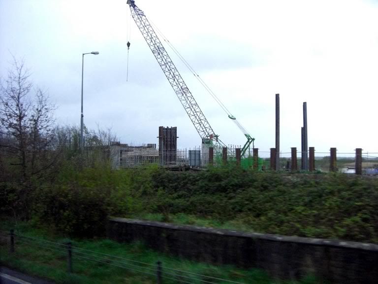
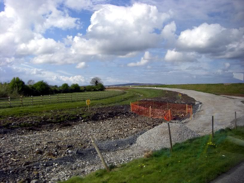
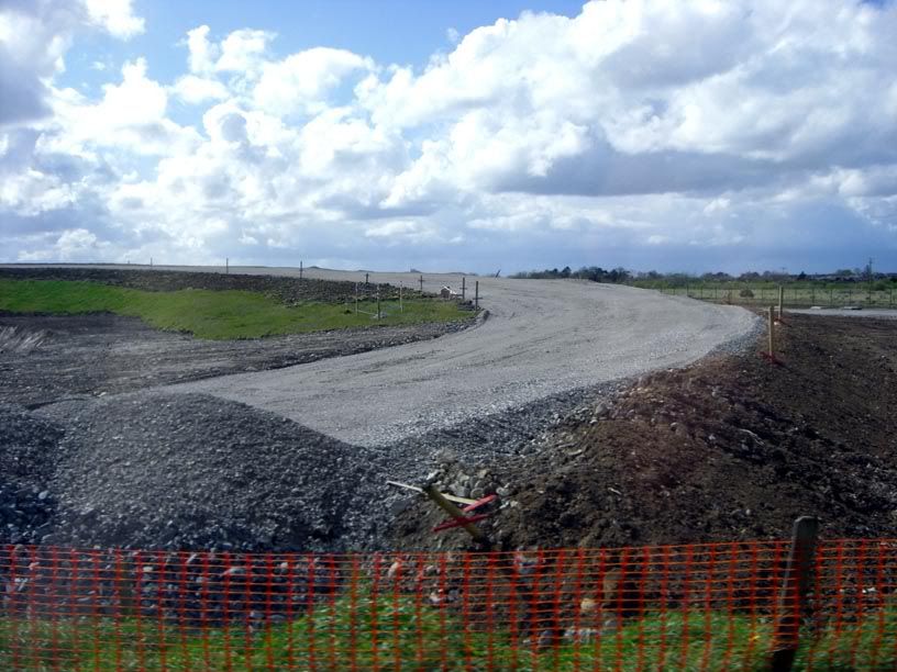
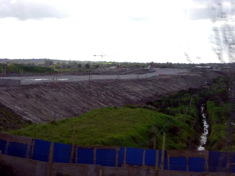
    Heres some apalling pics taken out of the bus window the other day -

    N18 tie in

    CIMG0971.jpg

    Clonmacken link (blurred :( )

    CIMG0974.jpg

    Rossbrien from afar -

    CIMG0975.jpg

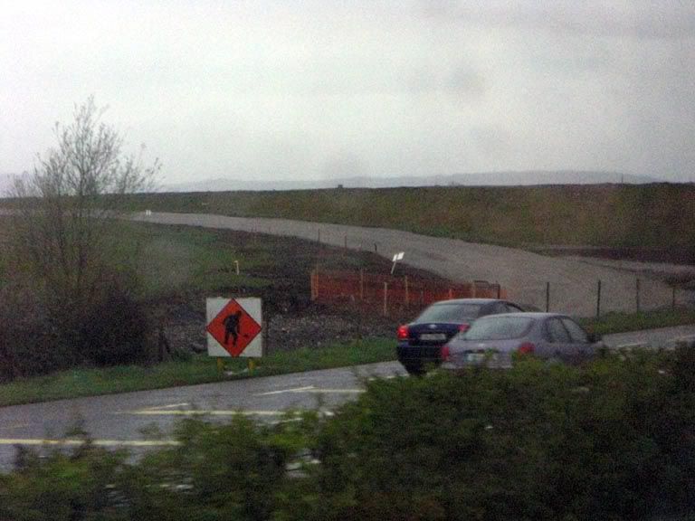
    Looking towards Rossbrien from the south -

    CIMG0980.jpg


  • Closed Accounts Posts: 3,082 ✭✭✭Chris_533976


    Got the bus back today :D

    South part of Rossbrien ->

    CIMG0987.jpg

    North part of Rossbrien ->

    CIMG0988.jpg

    (Impossible to take good pics from a bus window)


    Clonmacken link road ->

    CIMG0991.jpg

    Approaching N18 tie-in

    CIMG0992.jpg

    N18 tie-in

    CIMG0993.jpg


  • Closed Accounts Posts: 24 smashingred


    Is it just me or do the photographs on the limericktunnel website need to be updated?
    Sure they provide the newsletter @ quarterly intervals but alot of the photographs look a year or two old.


  • Closed Accounts Posts: 3,010 ✭✭✭Tech3


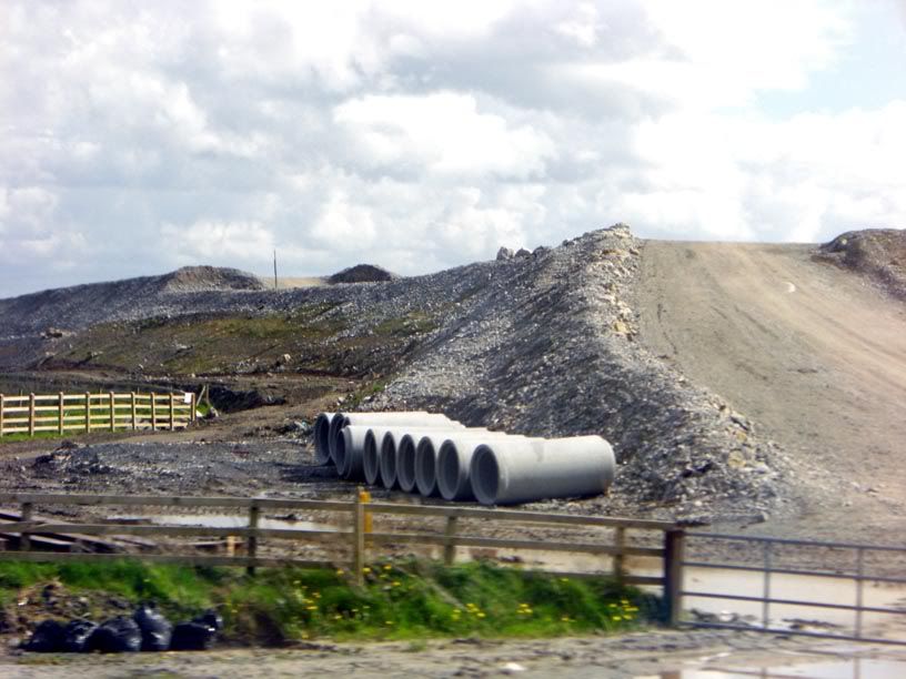
    Heres an update on the mainline of the N7 southern ring road. Its basically the most advanced section of mainline I've seen of the route thus far. The bridge in the background is the loopy crescent overbridge. Im looking eastbound. I have others but there really crap. Will get better ones in a few days.

    DSC01825.jpg


  • Registered Users, Registered Users 2 Posts: 1,639 ✭✭✭Zoney


    That bridge at the Crescent looks nice from far back, and it does the job, but walking across it on a windy day recently it was very serious effort involved. It seems the wind flies straight up over it and down again the other side - it's like walking up a wind tunnel. And that's with half of it not yet completed - it will surely be worse once the ramp is finished and the other solid barrier put up.

    Not to mention the veritable mountain it presents for anyone who has a buggy, is elderly, etc.

    I'm not at all sure there won't be trouble over this bridge.

    Also it's very dodgy crossing the off-ramp for the Crescent - coming down from the bridge if you go to the crossing position, you can't see traffic behind you (that may or may not be turning) due to the crash barrier. Not to mention that with the steep decline and sharp turn, there should be a barrier between traffic and pedestrians on the footpath on the outer curve of the off-ramp, in case someone hits it too fast and flies off onto the pavement.


  • Advertisement
  • Closed Accounts Posts: 3,010 ✭✭✭Tech3


    Zoney wrote: »
    Also it's very dodgy crossing the off-ramp for the Crescent - coming down from the bridge if you go to the crossing position, you can't see traffic behind you (that may or may not be turning) due to the crash barrier. Not to mention that with the steep decline and sharp turn, there should be a barrier between traffic and pedestrians on the footpath on the outer curve of the off-ramp, in case someone hits it too fast and flies off onto the pavement.

    Exactly :D. It will looks great on the mainline same could be said while actually driving across the bridge. A lad at work at work thought it was a temporary job until I told him its going to be like that permanently! He still thought I was joking.

    Btw the bridge I took the pic is on the road turnoff for the private hospital on the dock road and you come across the bridge. It takes you to father russell road. Strange that little road isint on google maps!


  • Registered Users, Registered Users 2 Posts: 850 ✭✭✭pajoguy


    I think the idea to have no access to the city centre from the N20 near the Maldon(Quality) Hotel might prove to be a serious error of judgement. This will drive traffic either to dock road/ballysimon road or city turn off at the rosbrien interchange and head to the city via the crescent. Its a huge diverision for anybody who wants to get to the top of William St. and beyond!


  • Registered Users, Registered Users 2 Posts: 1,639 ✭✭✭Zoney


    pajoguy wrote: »
    I think the idea to have no access to the city centre from the N20 near the Maldon(Quality) Hotel might prove to be a serious error of judgement. This will drive traffic either to dock road/ballysimon road or city turn off at the rosbrien interchange and head to the city via the crescent. Its a huge diverision for anybody who wants to get to the top of William St. and beyond!

    There wasn't judgment involved as far as I know. The council of the time asked for the link to be omitted at the behest of local interests in that area, and the NRA just complied. It's not really to do with planning as such from what I gather - although the poor road infrastructure city-bound from there is given as an excuse for removing the link.

    Anyone familiar with Limerick traffic and the current state of the Dock Road and the Tipp Road (and the junction with the ring road) can only but baulk at the chaos that will ensue with the new layout (although most likely it will simply restore the old N20, the R526 Patrickswell-Limerick and St. Nessan's Road, to pre-bypass traffic levels or higher).


  • Closed Accounts Posts: 3,010 ✭✭✭Tech3


    Asphalt is starting to go down on the westbound carriageway on the eastern side of the Crescent overbridge.


  • Registered Users, Registered Users 2 Posts: 1,412 ✭✭✭Road-Hog


    Is it just me or do the photographs on the limericktunnel website need to be updated?
    Sure they provide the newsletter @ quarterly intervals but alot of the photographs look a year or two old.


    And we in the south east area of the country thought the N25 Bypass Web site photos were out of date:D at least we have some pics on it from may this year....:)


  • Registered Users, Registered Users 2 Posts: 1,639 ✭✭✭Zoney


    tech2 wrote: »
    Asphalt is starting to go down on the westbound carriageway on the eastern side of the Crescent overbridge.

    Looks like it will be two lane + HS with no central reserve - i.e. not very upgradable to three lanes despite the fact this will likely be busier than the phase 1 section (which has a reserve and space on the verges to allow three lanes).


  • Advertisement
  • Closed Accounts Posts: 3,010 ✭✭✭Tech3


    Zoney wrote: »
    Looks like it will be two lane + HS with no central reserve - i.e. not very upgradable to three lanes despite the fact this will likely be busier than the phase 1 section (which has a reserve and space on the verges to allow three lanes).

    Yeah it should have a central reserve no doubt about it but judging from the view on the overbridge it doesnt look like there will be one. I have some photos to upload will put them up in a few days. 3+3 needed is a real possibility in the future.

    Also Zoney did you notice that commuters might be able avoid the clonmacken and mainline toll plaza? I think if you go to Coonagh west there might be access there onto the interchange from the local road?


  • Registered Users, Registered Users 2 Posts: 1,639 ✭✭✭Zoney


    tech2 wrote: »
    Yeah it should have a central reserve no doubt about it but judging from the view on the overbridge it doesnt look like there will be one. I have some photos to upload will put them up in a few days. 3+3 needed is a real possibility in the future.

    Also Zoney did you notice that commuters might be able avoid the clonmacken and mainline toll plaza? I think if you go to Coonagh west there might be access there onto the interchange from the local road?

    I didn't notice that. To be honest, the phase 2 ring road could see queues from day 1 due to the omission of N20->Childers Road, and the miserable Dock Road junction (and miserable dock road). Tipp Road junction on existing N7 ring road is likely to get worse too - haven't been on it at rush hour recently but apparently it's pretty bad (although I believe the traffic lights are being used to put the queues onto N24 instead of the N7 mainline).


  • Closed Accounts Posts: 3,010 ✭✭✭Tech3


    Zoney wrote: »
    I didn't notice that. To be honest, the phase 2 ring road could see queues from day 1 due to the omission of N20->Childers Road, and the miserable Dock Road junction (and miserable dock road). Tipp Road junction on existing N7 ring road is likely to get worse too - haven't been on it at rush hour recently but apparently it's pretty bad (although I believe the traffic lights are being used to put the queues onto N24 instead of the N7 mainline).

    I can understand what your saying Zoney I live most of the time in Limerick and the state of the N24 at peak times is getting very bad. The problem with the dock road is that those 3 sets of traffic lights installed have caused major traffic problems which are not needed. It really all depends on how good the dock rd interchange will work.

    On the other side of it the tie in with the N18 is looking very impressive, the bridge being constructed is huge.


  • Closed Accounts Posts: 3,010 ✭✭✭Tech3


    Coonagh West Overbridge
    DSC02134.jpg


    Ballykeefe Overbridge Heading Eastbound (last month)
    DSC01829.jpg


    Ballykeefe Overbridge Heading Eastbound (21st June)
    DSC02136.jpg


    Dock Rd Interchange from Ballykeefe Overbridge
    DSC02135.jpg


    View of the Crescent Overbridge
    DSC02144.jpg


    Eastbound from Crescent Overbridge
    DSC02143.jpg


  • Closed Accounts Posts: 5,133 ✭✭✭mysterious


    I thought the Limerick tunnel road was wide median?????


    Bastards...


  • Advertisement
  • Closed Accounts Posts: 3,082 ✭✭✭Chris_533976


    Its absolutely stupid to make this narrow median.

    The tunnel I guess will be as narrow as they can make it (a 3x3 capable tunnel would have cost a lot more I think), but still. This should have been wide median, its stupid that it isnt. And I'll bet the bridges wouldnt be able to take another lane either.

    Also this scheme is just going so slowly.


  • Closed Accounts Posts: 5,133 ✭✭✭mysterious


    Its absolutely stupid to make this narrow median.

    The tunnel I guess will be as narrow as they can make it (a 3x3 capable tunnel would have cost a lot more I think), but still. This should have been wide median, its stupid that it isnt. And I'll bet the bridges wouldnt be able to take another lane either.

    Also this scheme is just going so slowly.


    It was meant to be wide median, any motorway close to cities should be wider median this road will carry 40,000 vehicles a day, on opening it will carry 25,000 +.. I agree this is just stupid.


  • Closed Accounts Posts: 20,009 ✭✭✭✭Run_to_da_hills


    mysterious wrote: »
    I thought the Limerick tunnel road was wide median?????


    Bastards...
    Who cares, everyone including myself will be still using the Dock road to avoid the toll. :P


  • Closed Accounts Posts: 3,010 ✭✭✭Tech3


    Who cares, everyone including myself will be still using the Dock road to avoid the toll. :P

    No way I'll be using it at all times especially whenever I'm approaching from the N20. Also It takes about 10-15 mins for people on the Raheen side to get out to the N18 dc.

    Re the median, I agree its stupid it should be wide median


  • Registered Users, Registered Users 2 Posts: 850 ✭✭✭pajoguy


    I see they have almost finished installing the median crossing at the N-18 tie-in. The traffic restrictions will not be good for 12 months.


  • Closed Accounts Posts: 3,010 ✭✭✭Tech3


    Asphalt being layed down near the Ballykeefe Overbridge on the westbound carriageway.

    3698501958_aafe52acf1_b.jpg


  • Registered Users, Registered Users 2 Posts: 123 ✭✭black47


    Anyone heard anything further about earlier opening on the Rosbrien to Dock road section?

    I understand that Kirby Electrical have the M & E fitout for the tunnel and they are rumoured to be finishing next March. Throw in a month for testing the tunnel systems and the whole lot could be open by April 2010


  • Closed Accounts Posts: 3,082 ✭✭✭Chris_533976


    As far as I guess that will HAVE to happen otherwise accessing the city from the south (through the N20 North - Childers Road movement that will be removed) will be a massive pain in the neck.

    Opening Rossbrien to Dock Road will clog that road up something awful, but will be necessary I reckon.


  • Registered Users, Registered Users 2 Posts: 5 kingjohn


    How is work progressing on the tunnel itself. Seems there has not been alot of progress lately?


  • Closed Accounts Posts: 3,010 ✭✭✭Tech3


    kingjohn wrote: »
    How is work progressing on the tunnel itself. Seems there has not been alot of progress lately?

    Theres a new newsletter out Summer 2009 but the website hasnt updated it yet. As regards to the tunnel it is way offline for anyone to have a look at. Heres the update on the Ballykeefe overbridge:

    Eastbound
    DSC02324.jpg


    Westbound
    DSC02326.jpg


  • Advertisement
  • Registered Users, Registered Users 2 Posts: 242 ✭✭sonyair


    Its amazing what can be done when they want to, looks like they will open rosbrien to dock rd, the second roundabout was to be built in may at the dock rd on slip anybody know when this will start.
    Nice pics


  • Registered Users, Registered Users 2 Posts: 242 ✭✭sonyair


    poles have been erected for lighting at the dock rd exit


  • Closed Accounts Posts: 3,010 ✭✭✭Tech3


    sonyair wrote: »
    Its amazing what can be done when they want to, looks like they will open rosbrien to dock rd, the second roundabout was to be built in may at the dock rd on slip anybody know when this will start.
    Nice pics

    I agree there was not much done here until just over a month ago and the progress since has been staggering. Its possible that this section of road from the dock rd interchange-rossbrien could be open in a few months time. The tie in with phase 1 will be the toughest part I would imagine.


  • Registered Users, Registered Users 2 Posts: 242 ✭✭sonyair


    a lot of cones and lane changing to look forward to:D


  • Closed Accounts Posts: 3,010 ✭✭✭Tech3


    tech2 wrote: »
    DSC02324.jpg

    The layer thats missing on the pic is now laid down. This section is starting to belt ahead now.


  • Closed Accounts Posts: 5,133 ✭✭✭mysterious


    This is great news.

    I don't like the Dock road interchange at all. Its' nasty.:mad:

    Won't get started about how pathetic the NRA are.


  • Registered Users, Registered Users 2 Posts: 850 ✭✭✭pajoguy


    tech2 wrote: »
    I agree there was not much done here until just over a month ago and the progress since has been staggering. Its possible that this section of road from the dock rd interchange-rossbrien could be open in a few months time. The tie in with phase 1 will be the toughest part I would imagine.

    Thats the easy bit. No access to the city from rossbrien now thats the toughest part. This road looks like it has been designed to the minimum standard widths, curves and slip roads. The design of the rosbrien interchange looks very tight. Thats the problem with leaving the design to the contractors as opposed to the Adare - limerick scheme which is great it terms of alignment and widths and interchanges. Just my opinion.


  • Registered Users, Registered Users 2 Posts: 91 ✭✭clon


    july newsletter now available online,Cratloe bridge looks very impressive.

    http://www.limericktunnel.com/Downloads/Summer%202009.pdf


  • Closed Accounts Posts: 3,082 ✭✭✭Chris_533976


    N7 Tunnel newsletters are always the best. Lots of pics, lots of information.


  • Advertisement
  • Registered Users, Registered Users 2 Posts: 123 ✭✭black47


    Bad news on the early opening of this section folks. Got an email form Direct route yesterday stating emphatically that there were no plans to open this section ahead of overall completion next year. Too much trouble with tie-ins and traffic management


  • Closed Accounts Posts: 3,010 ✭✭✭Tech3


    black47 wrote: »
    Bad news on the early opening of this section folks. Got an email form Direct route yesterday stating emphatically that there were no plans to open this section ahead of overall completion next year. Too much trouble with tie-ins and traffic management

    Thats a pity but I can see them getting this section done early before the rest of it even if it does not open to traffic. Hard to tell when they will get this done as its not that long of a stretch.


  • Closed Accounts Posts: 20,009 ✭✭✭✭Run_to_da_hills


    black47 wrote: »
    Bad news on the early opening of this section folks. Got an email form Direct route yesterday stating emphatically that there were no plans to open this section ahead of overall completion next year. Too much trouble with tie-ins and traffic management
    Good news for the owners of the Tarbert Ferry, Im sure they are dreading the opening of this route. :p


  • Registered Users, Registered Users 2 Posts: 91 ✭✭clon


    In todays Irish Examiner, really very informative telling us that the tunnel is to open ahead of time by Sept. 2010.The 17th Sept 2010 is the date set on the tunnel website limericktunnel.com.

    http://www.examiner.ie/ireland/underwater-tunnel-highway-set-to-open-for-traffic-next-year-98040.html


  • Registered Users, Registered Users 2 Posts: 71,158 ✭✭✭✭L1011


    Good news for the owners of the Tarbert Ferry, Im sure they are dreading the opening of this route. :p

    Not really. Every time I've used the Tarbert ferry it was because the option of going through Limerick was just too long. The tunnel won't make the drive to Limerick from Clare and back to north Kerry any shorter, just the city bit of it!


  • Closed Accounts Posts: 3,082 ✭✭✭Chris_533976


    clon wrote: »
    In todays Irish Examiner, really very informative telling us that the tunnel is to open ahead of time by Sept. 2010.The 17th Sept 2010 is the date set on the tunnel website limericktunnel.com.

    http://www.examiner.ie/ireland/underwater-tunnel-highway-set-to-open-for-traffic-next-year-98040.html

    Fair play to the Mayor for having some fantastic facts at their disposal :rolleyes:
    Mayor of Limerick Cllr Kevin Kiely, following a visit to the tunnel site, said: "Such is the rate of progress being made, there is a good chance the tunnel will be open ahead of schedule as early as September 2010."

    Its been scheduled for September 2010 as early as 2006.


  • Advertisement
  • Registered Users, Registered Users 2 Posts: 1,639 ✭✭✭Zoney


    Google maps shows Listowel to Ennis as 1 hr 28 mins via ferry, and 1 hr 42 via Limerick, and that's before the 120 km/h sections of M18 and M20 come into effect, nevermind the tunnel!

    Obviously this example doesn't at all cover all cases (e.g. going from North Kerry to Kilkee or such) but it does illustrate that even more than at present, Tarbert Ferry will be strictly of use for local traffic only in the future.


  • Closed Accounts Posts: 5,133 ✭✭✭mysterious


    Surely it could open earlier than another year? It looks mostly done.


  • Registered Users, Registered Users 2 Posts: 4,739 ✭✭✭serfboard


    Zoney wrote: »
    Google maps shows Listowel to Ennis as 1 hr 28 mins via ferry, and 1 hr 42 via Limerick, and that's before the 120 km/h sections of M18 and M20 come into effect, nevermind the tunnel!

    Obviously this example doesn't at all cover all cases (e.g. going from North Kerry to Kilkee or such) but it does illustrate that even more than at present, Tarbert Ferry will be strictly of use for local traffic only in the future.

    Agreed. Having used the ferry a few times myself, when the tunnel is open their business will take a hit.


  • Closed Accounts Posts: 3,082 ✭✭✭Chris_533976


    mysterious wrote: »
    Surely it could open earlier than another year? It looks mostly done.

    There will be a lot of time due to testing and outfitting of the tunnel, then fire brigade training etc etc. I remember the Lee Tunnel being done for ages before it was opened.

    Tunnels are strange beasts. I do think it'll probably open a little early, but not terribly early. The tie in at the N18 end has a load of work to do too :(


  • Registered Users, Registered Users 2 Posts: 8,779 ✭✭✭Carawaystick


    A friend was telling me of a friend of his who worked in the M50 tunnel doing the finishing off work. There's a huge amount of health and safety checks to be done before any workers are allowed in to do any work, they were getting engineers to do labouring work as it was cheaper than qualifying up new people.

    Also the fans are very temperamental to install and there's very few people worldwide to make and install them.

    Then after the road is finished and ready to go, the operating staff need to be trained up and then the brigade. I understand the qualifying for these is based on a set period of time - so it can't be rushed by cramming or overtime.

    The M50 tunnel was finished boring in August 04[1], while the tunnel opened in December 06[2]

    The Jack Lynch tunnel took over 4 years of construction too[3]


    [1] http://www.friendsoftheirishenvironment.org/paperstoday/index.php?do=paperstoday&action=view&id=5029

    [2] http://www.dublinporttunnel.ie/about/

    [3] http://www.corkcorp.ie/roads/infrastructuralprojects/jacklynchtunnel/


  • Advertisement
This discussion has been closed.
Advertisement