Advertisement
If you have a new account but are having problems posting or verifying your account, please email us on hello@boards.ie for help. Thanks :)
Hello all! Please ensure that you are posting a new thread or question in the appropriate forum. The Feedback forum is overwhelmed with questions that are having to be moved elsewhere. If you need help to verify your account contact hello@boards.ie

Historic Dublin Pictures & Videos Thread

Options
1525355575863

Comments

  • Registered Users Posts: 2,923 ✭✭✭vektarman


    ziggy23 wrote: »
    Apologies if posted already just seen these on Facebook. Where the Church Bar is situated now on Jervis Street.

    486379_10151259467478609_877740492_n.jpg

    Interesting to see that this was a graveyard at one time.
    http://maps.osi.ie/publicviewer/#V1,715471,734491,7,9


  • Registered Users Posts: 24,993 ✭✭✭✭Wishbone Ash


    vektarman wrote: »
    Interesting to see that this was a graveyard at one time
    Many of the headstones are still there lined up on the southern side.


  • Registered Users Posts: 2,320 ✭✭✭p to the e


    Source:
    http://archiseek.com/2010/1998-wolfe-tone-square-jervis-street-dublin/

    The parish of St. Mary’s was large and wealthy and the graveyard became so overcrowded by the mid-nineteenth-century that ‘in order to make room for others, bodies were taken up in absolute state of putrefaction, to the great and very dangerous annoyance of the vicinity.’ By the 1940s, the large churchyard was being used as a playground, with the tombstones being removed to the further end of the yard. In April 1966, the Church of Ireland sold the graveyard to Dublin Corporation which later developed the site now known as Wolfe Tone Memorial Park. The park was laid out in a traditional formal style retaining the high defensive railings and placing the headstones around the perimeter.

    As part of the HARP Urban Renewal Project and in the context of the 200th anniversary of 1798 and Wolfe Tone’s association with the area, Dublin Corporation (now Dublin City Council) organised an international competition inviting ideas on the re-design of Wolfe Tone Memorial Park. The design competition was co-sponsored by the Royal Institute of Architects in Ireland and the Irish Landscape Institute.


  • Closed Accounts Posts: 15,515 ✭✭✭✭admiralofthefleet


    BowWow wrote: »
    Correct.

    i stand corrected, i always thought it was where dunnes is


  • Registered Users Posts: 10,263 ✭✭✭✭Standard Toaster


    Red Cow Lane, Smithfield c.1970


    230567.jpg

    230568.jpg
    Red Cow Lane, Smithfield c.2009


  • Advertisement
  • Registered Users Posts: 17,399 ✭✭✭✭r3nu4l


    While we're in that area, where was British Home Stores? Was it where Penny's is now.
    I thought there used to be an entrance to BHS on Middle Abbey Street? IIRC the offices of the Indo and the side entrance to Easons were close to it. My memory of that is hazy thought because my parents refused to shop in "British" Home Stores so we never went in there.


  • Registered Users Posts: 21,024 ✭✭✭✭Ash.J.Williams


    highdef wrote: »
    Well before the LUAS, there was a fierce amount of riding going on around there, if what I have heard and read can be believed
    yeah it was pretty bad...young junkies too


  • Registered Users Posts: 21,024 ✭✭✭✭Ash.J.Williams


    Not a photo but a map.
    that map reminds me!!

    When i started working fulltime in dublin around 1998, i was sent to clonbrasil st to a pub on "new st." I thought to myself what an unimaginitive name for a street, until i spotted it on a very early map of dublin!! It's been there for 1000 years!!


  • Closed Accounts Posts: 6,824 ✭✭✭Qualitymark


    that map reminds me!!

    When i started working fulltime in dublin around 1998, i was sent to clonbrasil st to a pub on "new st." I thought to myself what an unimaginitive name for a street, until i spotted it on a very early map of dublin!! It's been there for 1000 years!!

    And they *still* haven't taken the wrappings off!


  • Registered Users Posts: 1,724 ✭✭✭The Scientician


    Red Cow Lane, Smithfield c.1970


    230567.jpg

    230568.jpg
    Red Cow Lane, Smithfield c.2009

    I'm a bit confused. Is that a different tower in the background?


  • Advertisement
  • Registered Users Posts: 1,724 ✭✭✭The Scientician


    8227903374_2de67b0d3b_b.jpg

    Not too sure where that Hector Grey shop was. It doesn't appear to be the same location as the HG's I knew in later years.

    8226832993_da1d84736d_b.jpg

    You can probably guess where this is. :)

    8226832773_ae44982ed4_b.jpg

    This appears to be Dorset Street, facing what is now the Red Parrot.

    8227902892_d744851938_b.jpg

    The Old Cattle Mart, Hanlon's Corner, NCR.


  • Registered Users Posts: 1,724 ✭✭✭The Scientician


    8226832461_bf0355c552_b.jpg

    Anyone know the street? Says Pembroke Stores across the way, It's from 1946.

    8227902400_5fc026efa0_b.jpg

    Grafton St. I think. 1946.

    8227902102_5f9a123ac4_b.jpg

    O'Connell St. at the Pillar. 1946.

    8227901834_524029a97f_b.jpg

    Not too sure what street this is, Grafton again? 1946.


  • Registered Users Posts: 1,316 ✭✭✭Speedsie
    ¡arriba, arriba! ¡andale, andale!


    I'm a bit confused. Is that a different tower in the background?

    They added a viewing platform to the tower in the early 2000's - but it is the same one alright!


  • Registered Users Posts: 1,316 ✭✭✭Speedsie
    ¡arriba, arriba! ¡andale, andale!


    Grafton St. I think. 1946.


    Not too sure what street this is, Grafton again? 1946.

    Woolworth's and Slyne's were both on Grafton Street, so you are correct there. Woolworth's in now HMV and Slyne's in Boodles.


  • Registered Users Posts: 1,724 ✭✭✭The Scientician


    8227901526_893146f0dd_b.jpg

    Famous enough picture from the time of the 1913 Lockout I do believe.

    8226831095_6f7b985ea7_b.jpg

    Not too sure what street. 1920

    8227901134_ce26ede0da_b.jpg

    Westland Row, 1946

    8226830607_fdcb5ec0b0_b.jpg

    O'Connell St, 1946. Check out the road sign pointing to Donegal and Derry. :)

    8226830321_8e1277b995_b.jpg

    O'Connell St, 1946. I feel like chicken tonight.


  • Registered Users Posts: 1,724 ✭✭✭The Scientician


    8227900288_5e262bf70e_b.jpg

    1920. Haven't a clue what street.

    8227900088_870153914f_b.jpg

    1922. Someone might be able to tell the street by that somewhat ornate building in the background.

    8227899918_43fab3f0c5_b.jpg

    This is dated 1920 as well but no location given.

    8227899762_27a0c6a09e_b.jpg

    Wood Quay.


  • Registered Users Posts: 1,724 ✭✭✭The Scientician


    Speedsie wrote: »
    They added a viewing platform to the tower in the early 2000's - but it is the same one alright!

    I know it's a slightly different angle but to me the tower looks further away in the newer picture. :confused:


  • Registered Users Posts: 1,768 ✭✭✭BowWow


    8226832461_bf0355c552_b.jpg
    Anyone know the street? Says Pembroke Stores across the way, It's from 1946.

    I think it's the Baggot St end of Lr Pembroke St - taken from where Louis Copelands is now.


  • Registered Users Posts: 2,923 ✭✭✭vektarman


    8227900088_870153914f_b.jpg

    1922. Someone might be able to tell the street by that somewhat ornate building in the background.


    That looks like the corner of Temple Street South and Dame Street (opposite Georges Street)


  • Registered Users Posts: 1,724 ✭✭✭The Scientician


    vektarman wrote: »
    That looks like the corner of Temple Street South and Dame Street (opposite Georges Street)

    Begob, I believe you're right.


  • Advertisement
  • Registered Users Posts: 3,674 ✭✭✭Faith+1


    r3nu4l wrote: »
    I thought there used to be an entrance to BHS on Middle Abbey Street? IIRC the offices of the Indo and the side entrance to Easons were close to it. My memory of that is hazy thought because my parents refused to shop in "British" Home Stores so we never went in there.

    We must have the same parents....:rolleyes:


  • Registered Users Posts: 3,624 ✭✭✭Dancor


    I'm suprised a shop existed in central Dublin named 'British home stores'. Especially during the eighties.


  • Registered Users Posts: 5,502 ✭✭✭bb1234567


    Dublin used to be so classy...not so much now.


  • Closed Accounts Posts: 3,912 ✭✭✭HellFireClub


    Would anyone know if there are any images available of Templebar around the year 1855? In particular Essex Street East or around that area, time period between 1850's and 1900's?


  • Registered Users Posts: 24,993 ✭✭✭✭Wishbone Ash


    Dancor wrote: »
    I'm suprised a shop existed in central Dublin named 'British home stores'. Especially during the eighties.
    Well it was commonly known as "BHS". A lot of people did not know what B.H.S. stood for - a bit like H.M.V. etc.


  • Closed Accounts Posts: 6,824 ✭✭✭Qualitymark


    Well it was commonly known as "BHS". A lot of people did not know what B.H.S. stood for - a bit like H.M.V. etc.

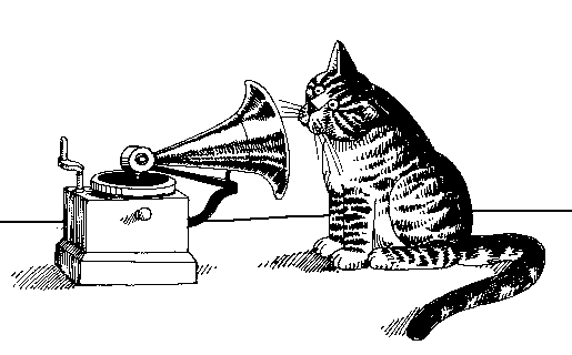
    HMV, of course, stands for "His master's voice":

    Voice.gif


  • Registered Users Posts: 1,645 ✭✭✭ollaetta


    BowWow wrote: »
    I think it's the Baggot St end of Lr Pembroke St - taken from where Louis Copelands is now.

    Just checked Street View and the shops Pembroke Stores and The Good Earth beside it are now the Louis Copeland premises: Pembroke Street Lower


  • Registered Users Posts: 1,645 ✭✭✭ollaetta


    8227899918_43fab3f0c5_b.jpg

    This is dated 1920 as well but no location given.

    This one is really puzzling me. The only Liffey bridge with lattice work is Grattan Bridge and it's not there. Anyone got any ideas?


  • Registered Users Posts: 2,923 ✭✭✭vektarman


    ollaetta wrote: »
    This one is really puzzling me. The only Liffey bridge with lattice work is Grattan Bridge and it's not there. Anyone got any ideas?

    I thought for a while that it might be Kingsbridge with Parkgate Street across on the right and also because the river sweeps to the left after the bridge, but then there seems to be a ship moored just after the bridge and ships didn't travel that far upriver AFAIK.


  • Advertisement
  • Closed Accounts Posts: 1,449 ✭✭✭nudger


    vektarman wrote: »
    I thought for a while that it might be Kingsbridge with Parkgate Street across on the right and also because the river sweeps to the left after the bridge, but then there seems to be a ship moored just after the bridge and ships didn't travel that far upriver AFAIK.

    Think your right the ship might be a Guinness Barge, they could lower their funnel going under the bridges.


Advertisement