Advertisement
If you have a new account but are having problems posting or verifying your account, please email us on hello@boards.ie for help. Thanks :)
Hello all! Please ensure that you are posting a new thread or question in the appropriate forum. The Feedback forum is overwhelmed with questions that are having to be moved elsewhere. If you need help to verify your account contact hello@boards.ie

M7 - Nenagh to Limerick

Options
1232426282978

Comments

  • Registered Users Posts: 19,019 ✭✭✭✭murphaph


    This situation can't be unique nor can it be the most complex engineering problem to have been solved in the last 50 years. A solution exists.


  • Closed Accounts Posts: 3,010 ✭✭✭Tech3


    The NRA need to give a statement whether this road is going to be partially opened or not. Nenagh to Birdhill should be lined and studded by now but it's not. The pace of construction on this scheme is still unbeliveably slow considering this should have opened this time last year ideally.


  • Closed Accounts Posts: 5,133 ✭✭✭mysterious


    Yeah I was told the engineers were surveying it and a farmer said, you aint going to put a road there and he bet them if they parked a vehicle there and returned the next day he would be have gone or disappeared. Returned the next day and it was sunk into the ground.

    They tried putting rods into the ground to a fairly substantial level and still couldnt find the bottom.

    Regarding the pillars Berty, it would be one long fecking bridge! I dont think they can go around it. And as far as opening the motorway as far as birdhill, that is a joke in itself. How can they expect that to work?

    The cars coming off the motorway will have to give way to the cars coming from the right which will have to way to the cars coming from Killaloe

    They won't because it will be a roundabout.


  • Registered Users Posts: 26,149 ✭✭✭✭Berty


    Here are some pics from this morning.

    Who is this? Is this you? Did you have a dog with you?

    PICT0829.jpg

    Bridge south of Dalys Cross towards bog of doom

    PICT0830.jpg

    Standing on the Bog looking East

    PICT0831.jpg

    This is the aggregate which they have placed on top of the slab. Now this is where it is confusing. There is sooooo much snow it was hard to see where the slab started or where the joints were. You will see in a later picture they are using a waterproofing sheet across the slab to create a barrier between this aggregate and the slab itself. The Aggregate itself was not levelled off yet.

    PICT0832.jpg

    This picture is showing a previous picture I took but now cannot find. It is looking west/north along the slab towards the old N7.

    PICT0833.jpg

    This is where the road starts to rise up so it can pass over the next overpass. Still a bit higgildy piggildy.

    PICT0834.jpg

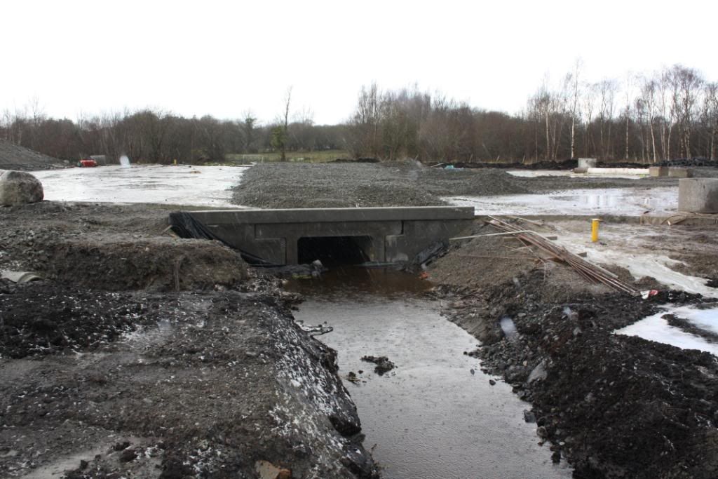
    Here you can see the slab where the bottom of the previous picture passes over a culvert and meets back up with the aggregate on the slab. You can see the waterproof sheeting. Im surprised they did not decide to waterproof the entire deck like they would a bridge. :confused:

    PICT0835.jpg

    The same area looking back towards Limerick and up to the incline of the aggregate heading for the overpass.

    PICT0836.jpg

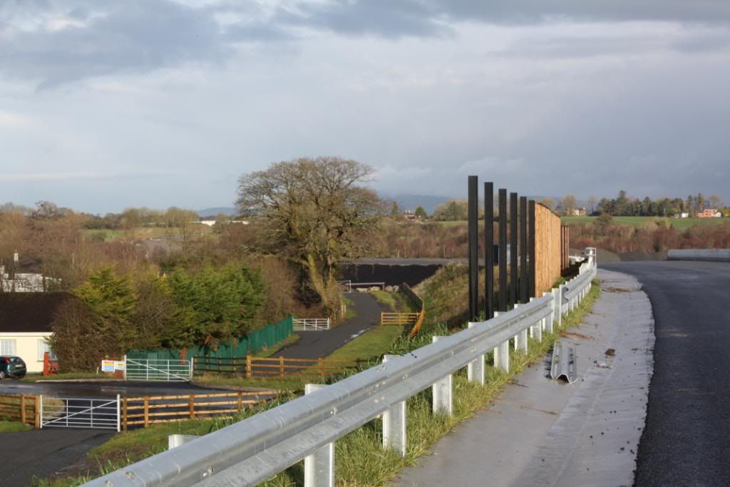
    Looking towards Dublin. You can barely make out the structure of the bridge just south of Dalys cross.

    PICT0837.jpg

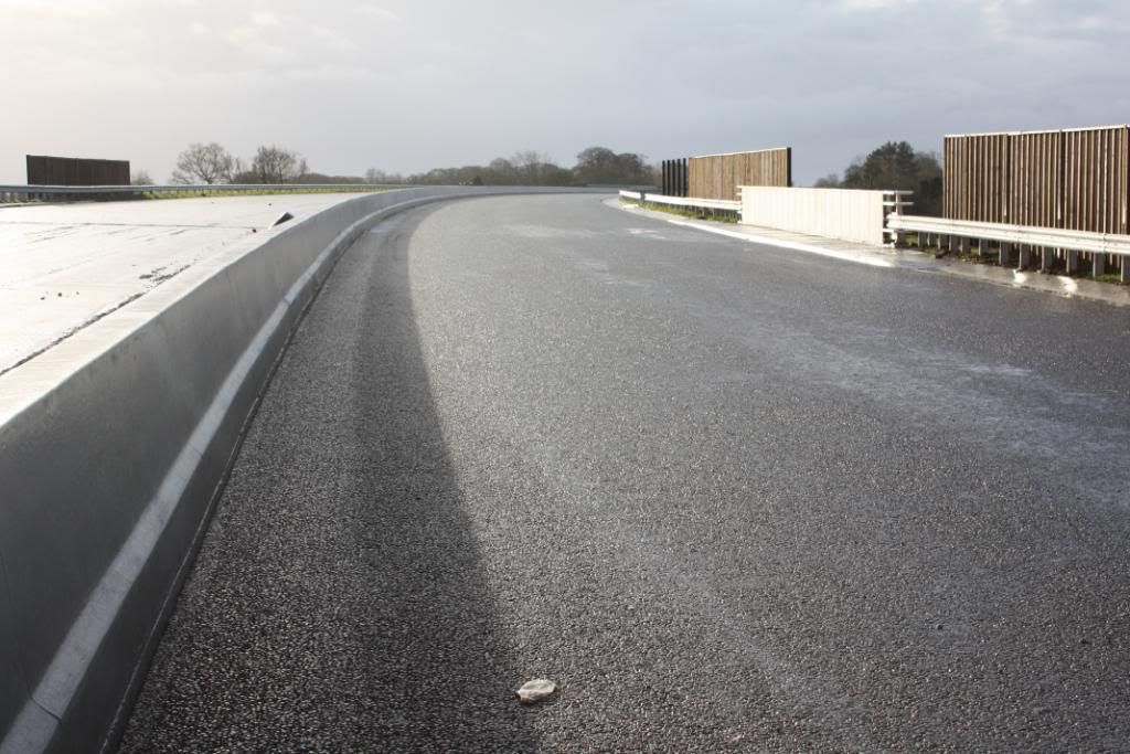
    This is where the road turns and put a slight angle to the road, needing drainage otherwise the water will build up along the centre median.

    PICT0838.jpg

    Sign of the times. I will return in 12 months and take the same picture because likely the milk bottle will still be there with no road open. :eek: I kid I kid.

    PICT0839.jpg

    The only traffic this road is likely to get any time soon.

    PICT0840.jpg


  • Registered Users Posts: 368 ✭✭Roryhy


    Is this armageddon? Looks spooky. Thanks for the effort.


  • Advertisement
  • Registered Users Posts: 1,284 ✭✭✭D.L.R.


    Love the third shot


  • Registered Users Posts: 26,149 ✭✭✭✭Berty


    Ok so this is where the bog is at:

    Start

    Nenagh-Limerick4.jpg

    PICT0690.jpg

    PICT0689.jpg

    PICT0687.jpg

    PICT0688.jpg

    PICT0692.jpg

    PICT0832.jpg

    Now

    PICT0833.jpg


  • Registered Users Posts: 203 ✭✭bacon&cabbage


    I e-mailed the NRA before Christmas regarding the Bog of Doom and the expected opening date(s) for the scheme. This is the repy i received:


    Dear _______,

    Thank you for your correspondence of 23rd December, 2009, regarding the M7 Nenagh to Limerick Scheme.

    Progress on the scheme is behind schedule. A 7km section of the scheme upgrading the Nenagh BP to Motorway and a new Interchange on the Nenagh-Thurles road opened on Dec 17th last. It is anticipated the whole of the works will be complete in late March 2010 with the possibility that parts of the works most notably the Nenagh to Birdhill section (approx 15.5 km) may be completed by late January 2010. All earthworks are complete in Annaholty bog where pavement materials are currently being laid.

    Regards,

    ________


  • Closed Accounts Posts: 5,133 ✭✭✭mysterious


    The Nenagh Birdhill section will be gladly welcomed by the end of this month. The old road is far to busy and dangerous around there, with many S bends and sharp turns before Birdhill.

    This whole scheme opening will boost the region :)


  • Closed Accounts Posts: 878 ✭✭✭rainbowdash


    I was talking to a lad yesterday who works on tarring it and he said no tar for the foreseeable future due to the cold ground. Reckons with the right weather 6 weeks would do it.


  • Advertisement
  • Registered Users Posts: 26,149 ✭✭✭✭Berty


    I was talking to a lad yesterday who works on tarring it and he said no tar for the foreseeable future due to the cold ground. Reckons with the right weather 6 weeks would do it.

    The Temperature must be 3 and rising AFAIK. It could be 2 though. Im sick. :mad:


  • Closed Accounts Posts: 26 youlickmagee


    Hi All, Some Pictures from St Stephens Morning: You lot may be able to explain what we are looking at (Hope these show up now!! First time posting photos)

    IMG_1366.jpg
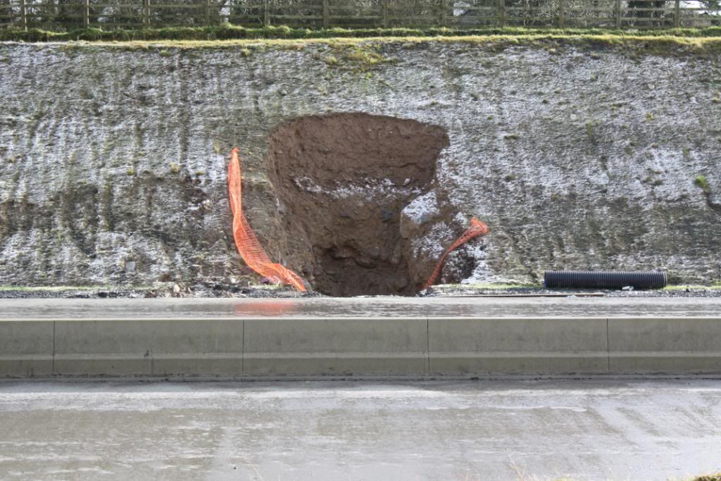
    Big Hole (Only put in in last few weeks I think)


    IMG_1371.jpg
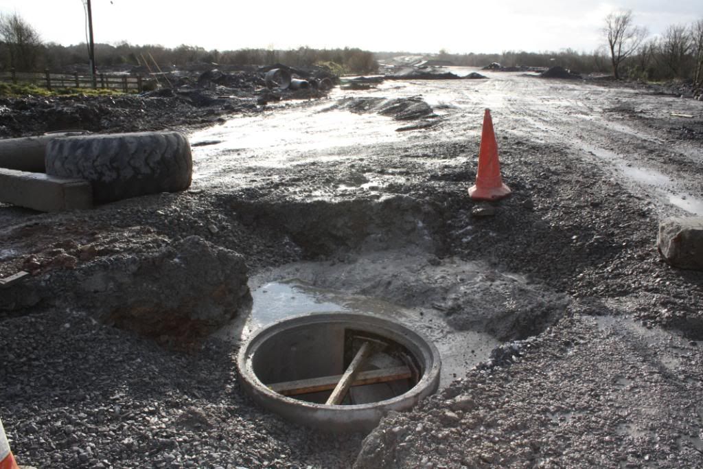
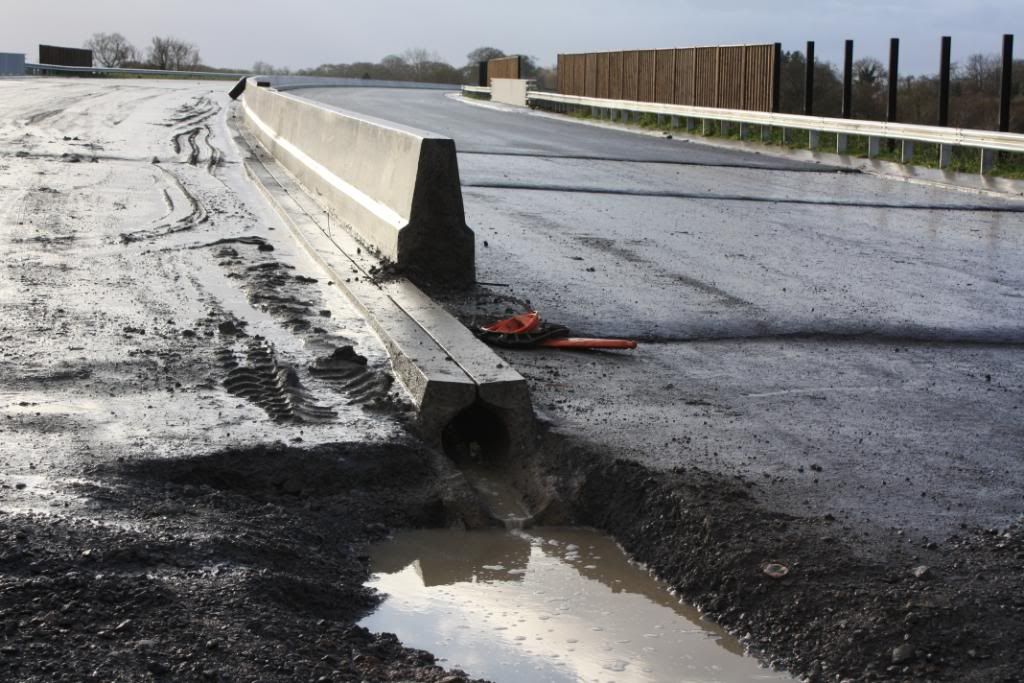
    Drain / man/personhole
    IMG_1370.jpg
    Looking north
    IMG_1379.jpg
    Big Pit to Existing N7 Side of New road
    IMG_1387.jpg
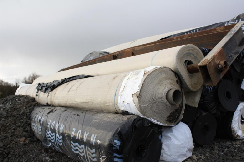
    Rolls of material left at site

    IMG_1396.jpg
    Culvert With deck sloping down to it.Do not think this was there 8 or 9 weeks ago..Could be wrong

    IMG_1398.jpg
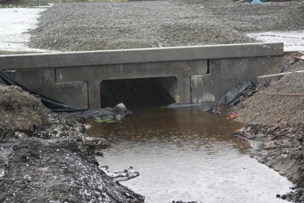
    Closer View of above

    IMG_1399.jpg
    Looking north, construction traffic seems to need to avoid this piece of deck, you can see where it detours on the right which is directly above the culvert shown above

    IMG_1402.jpg
    Left side of Culvert
    IMG_1409.jpg
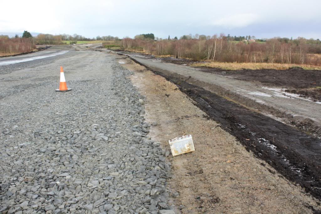
    Looking north, note use of local peat to dress bank
    IMG_1419.jpg
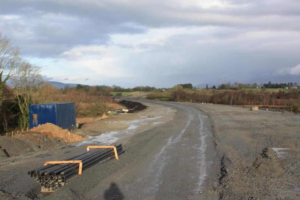
    Looking South towards Limerick
    IMG_1420.jpg
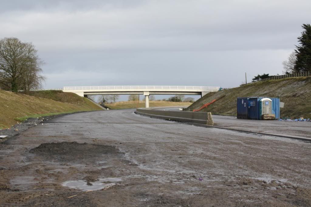
    looking North, you can see over bridge in distance,
    IMG_1425.jpg


    IMG_1426.jpg
    Again Looking North, love the way that this shot shows elevation difference on both sides of bog

    Panorama1.jpg
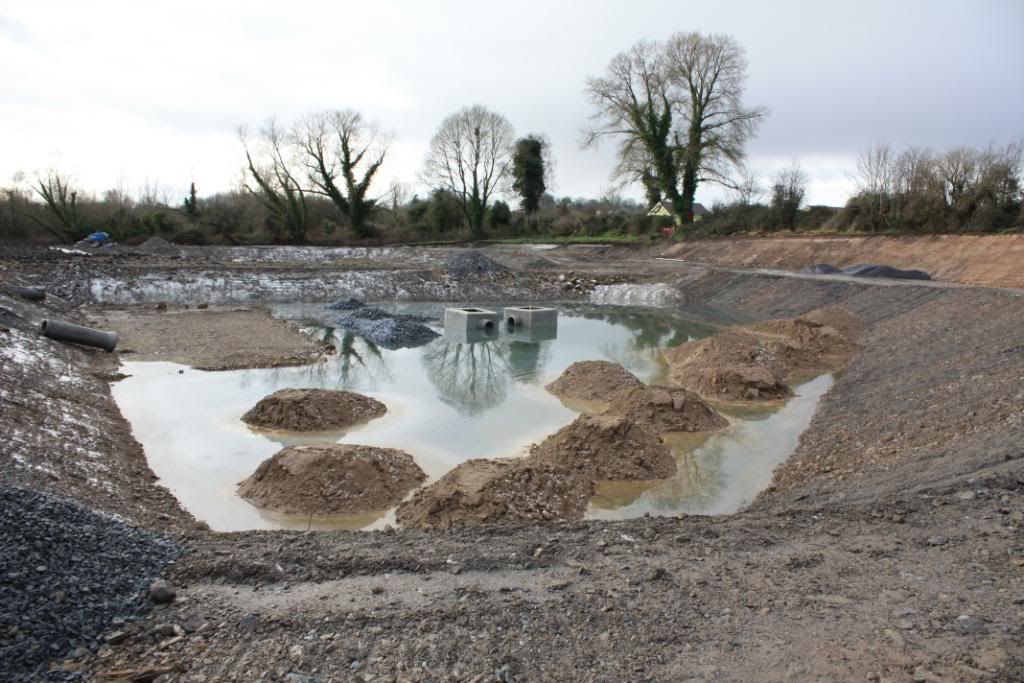
    Finally a panorama of the drainage pit shown above


  • Registered Users Posts: 2,884 ✭✭✭101sean


    The badly fenced deep excavation is probably a gantry base. The large open excavation will be a settlement lagoon (must about 70 of them on the whole job). There's certainly a lot of unfinished work there although progress can be quick given the right conditions.

    You can't concrete below 4deg on a falling thermometer or below 0deg on a rising one so that's January out for concreting, can't remember rules for tarmacing but can't imagine much being done.

    The finish on cutting/embankment slopes varies from place to place, ie peat in the bog areas but most are finished in subsoil rather than topsoil.


  • Closed Accounts Posts: 5,133 ✭✭✭mysterious


    101sean wrote: »
    The badly fenced deep excavation is probably a gantry base. The large open excavation will be a settlement lagoon (must about 70 of them on the whole job). There's certainly a lot of unfinished work there although progress can be quick given the right conditions.

    You can't concrete below 4deg on a falling thermometer or below 0deg on a rising one so that's January out for concreting, can't remember rules for tarmacing but can't imagine much being done.

    The finish on cutting/embankment slopes varies from place to place, ie peat in the bog areas but most are finished in subsoil rather than topsoil.

    Well I think its only a small section which can be finished quick enough given the fact that the rest of the scheme is almost complete. The Birdhill Nenagh section opening at the end of Jan is so exciting to me:D


  • Registered Users Posts: 19,019 ✭✭✭✭murphaph


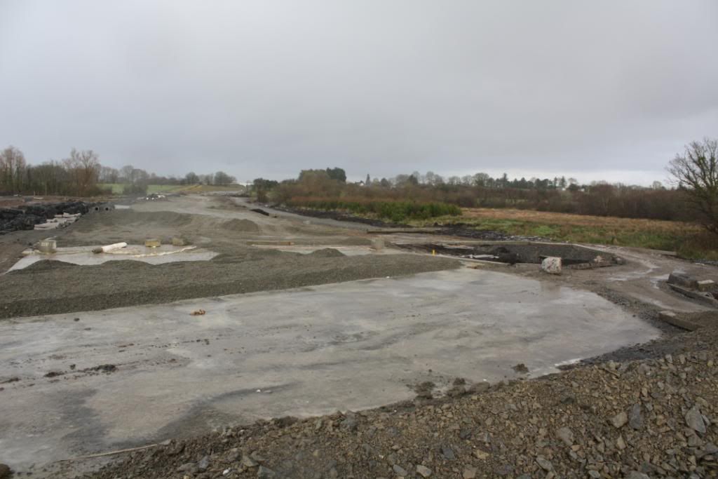
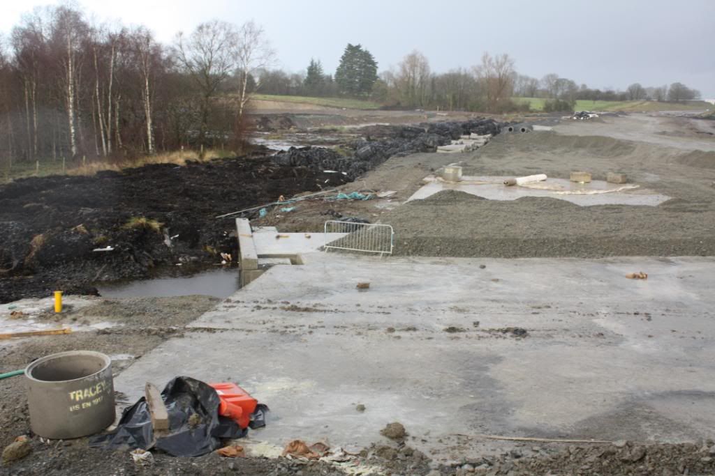
    I wonder was the plan all along to lay all that aggregate atop the concrete slab, or was that a "let's see if this works" solution. If it was the plan all along and they didn't intend the slab to be perfectly flat than good job.


  • Closed Accounts Posts: 10,025 ✭✭✭✭-Corkie-


    great pictures on last page. at least some one is making an effort id love to throw brian cowen in to that big hole and a few more of them


  • Registered Users Posts: 26,149 ✭✭✭✭Berty


    murphaph wrote: »
    I wonder was the plan all along to lay all that aggregate atop the concrete slab, or was that a "let's see if this works" solution. If it was the plan all along and they didn't intend the slab to be perfectly flat than good job.

    Yes it would have been the plan all along.

    It would be like building the foundations of a house and trying to lay a roof on a house without walls.

    The aggregate is merely the standard sub base in order to pour a suitable layer of blacktop.

    The concrete is merely a barrier to prevent the blacktop/aggregate from sinking.

    Although the concrete is also porous it is not as porous as loose/compacted aggregate without binding so along with the structural properties to prevent it from sinking therein lies your answer.


  • Registered Users Posts: 19,019 ✭✭✭✭murphaph


    So these delays have less to do with having to come up with this solution "on the fly" as it were? Somebody else was on here saying the slab was buckling (used a photo on here as evidence, can't remember who it was) but it seems it was laid like that, ie, not perfectly flat, rather following the undulations of the ground, with a view to levelling it out later with this aggregate.


  • Closed Accounts Posts: 3,082 ✭✭✭Chris_533976


    So long as the whole thing doesnt sink more after the tar has been put on it.


  • Registered Users Posts: 19,019 ✭✭✭✭murphaph


    So long as the whole thing doesnt sink more after the tar has been put on it.
    Has the concrete deck sunk at all though? It doesn't look like it to me and they'd know it would be futile just piling thousands of tonnes of aggregate on top and crossiing their fingers.


  • Advertisement
  • Closed Accounts Posts: 3,010 ✭✭✭Tech3


    murphaph wrote: »
    It doesn't look like it to me and they'd know it would be futile just piling thousands of tonnes of aggregate on top and crossiing their fingers.

    I agree with this. Surely tests are carried out to make sure the foundation is stable enough before carrying out the next phase of the construction?


  • Registered Users Posts: 26,149 ✭✭✭✭Berty


    tech2 wrote: »
    I agree with this. Surely tests are carried out to make sure the foundation is stable enough before carrying out the next phase of the construction?

    I do know of a few load bearing tests used on Aggregate to see whether the compaction is suitable for tarring but Im unaware on how it would work on a bog because Im struggling to understand how they get the load bearing equipment under the slab.

    Short of putting a measuring rod in the ground next to it and putting a number of A40's on top of it and coming back the next day to see how much down the rod it sank then Im stumped.


  • Registered Users Posts: 1,265 ✭✭✭ciarriaithuaidh


    That bog must be something else if the longest piles available wouldnt make a difference...how long a section of the road is this effecting lads?
    Guess the engineering "geniuses" will have to earn their corn then eh? Funnily enough the sorry tale of the bog just reminded me of the problems the Chinese had with that rail-line to Lhasa...they had a section (few hundred kms i think) going through permafrost which is rock solid at a certain depth obviously, but pure muddy sh*te in summer..they built bridges over it,but the method of stabilising the ground beneath the tracks was ingenius...look it up. http://en.wikipedia.org/wiki/Qingzang_railway
    Different scenarios of course, but similar ingenuity required.


  • Closed Accounts Posts: 254 ✭✭The Word Is Bor


    Rod and plate gauges are a crude manner in which to determine settlement over a period of time. I would think that given the location and the nature of the underlying surface that piezometers would be used to measure settlement over a period of time.

    As for the piles. The piles they chose were not long enough. They then tried to add another lenght of pile on top of the previous pile but the piles 'kicked' and were therefore rendered useless.


  • Banned (with Prison Access) Posts: 25,234 ✭✭✭✭Sponge Bob


    What is holding that slab up so ??? permafrost ??


  • Registered Users Posts: 19,019 ✭✭✭✭murphaph


    Rod and plate gauges are a crude manner in which to determine settlement over a period of time. I would think that given the location and the nature of the underlying surface that piezometers would be used to measure settlement over a period of time.

    As for the piles. The piles they chose were not long enough. They then tried to add another lenght of pile on top of the previous pile but the piles 'kicked' and were therefore rendered useless.
    So in your opinion the slab is no good and tehy are wasting their time puuting aggregate on top of it?


  • Closed Accounts Posts: 254 ✭✭The Word Is Bor


    murphaph wrote: »
    So in your opinion the slab is no good and tehy are wasting their time puuting aggregate on top of it?

    The piles I was referring to where the original solution. They slab in the photos is the remedial measure. I don't know what they have done underneath. They may have re-piled by using longer continuous piles.

    I don't have an opinion one way or the other on the current solution other than there are encouraging noises eminating from the contractor/NRA/rumour mill that the full opening will be in March/April. So there I would presume all are confident that the road will remain in tact for the opening day. As for long term settlement that is a different bag of spanners.;)


  • Banned (with Prison Access) Posts: 25,234 ✭✭✭✭Sponge Bob


    As for long term settlement that is a different bag of spanners.;)
    As long as we can see some of it sticking out of the bog then we can drive on it , rather slowly maybe but nevertheless :cool:


  • Registered Users Posts: 2,884 ✭✭✭101sean


    There are piezometers and settlement gauges installed at various locations, don't know about the bogs though.

    The standard sub-base test prior to laying roadbase is a plate bearing test, basically put a plate on the ground, set up dial test indicators, jack a dumptruck off the plate and measure the movement.


  • Advertisement
  • Closed Accounts Posts: 254 ✭✭The Word Is Bor


    101sean wrote: »
    There are piezometers and settlement gauges installed at various locations, don't know about the bogs though.

    The standard sub-base test prior to laying roadbase is a plate bearing test, basically put a plate on the ground, set up dial test indicators, jack a dumptruck off the plate and measure the movement.

    Yeah, PBT's are done on the sub-formation (natural ground in cut and general fill on embankments) and formation (capping material- stone fill). The result gives a CBR (California Bearing Ratio). Anything less than 2% is generally considered to be very poor ground. A value of 15% would be required on the formation. A PBT couldn't be carried out on the concrete slab so there would be an expected settlement period which would be monitored. The actual settlement would be measured against the theoretical. A geotechnical engineer would then have to make a call on whether the road had adequately settled or required more time. A surcharging could be used to accelerate the settlement as well. It's all about risk management and when you have contractors involved they invariably take very big risks.

    On the sub-base (Cl. 804) NDT's (Nuclear Density Tests) are carried out to determine if the 804 has received the required compaction.

    A proof-roll of the sub-formation, formation and sub-base is also carried out to visually check for any movement in the surface.


This discussion has been closed.
Advertisement