Advertisement
If you have a new account but are having problems posting or verifying your account, please email us on hello@boards.ie for help. Thanks :)
Hello all! Please ensure that you are posting a new thread or question in the appropriate forum. The Feedback forum is overwhelmed with questions that are having to be moved elsewhere. If you need help to verify your account contact hello@boards.ie

M17/M18 - Gort to Tuam [open to traffic]

Options
1276277279281282319

Comments

  • Moderators, Entertainment Moderators, Science, Health & Environment Moderators Posts: 14,408 Mod ✭✭✭✭marno21


    Good to see it on the Google Map finally. Ballygaddy road slips are missing as of yet.

    Changes yet to be made to the existing N17, N18, N66, and N83, and the road still has to be labelled properly itself (M17 down to Gort at present).

    N11 between Arklow and Rathnew still hasn't been relabelled R772 so this could take some time yet.


  • Registered Users Posts: 9,491 ✭✭✭irishgeo


    sonnyblack wrote: »
    Drove this new road for the first time at the weekend. Mightily impressed. Knocked 30 minutes off my journey. Good surface. Impressed by bat bridge. The only gripe I would have, unrelated to new road, is that traffic volumes coming into Milltown & Ballindine have increased enormously. It's tough on the villagers living there. It's less than 28 kms to the Claremorris bypass from Tuam. I'd say the next target for western politicians will be to get the motorway extended this distance

    i am curious how you think milltown and ballindine have more traffic. The same amount of traffic is still that n17 as was on it before the motorway opened.


  • Registered Users Posts: 1,372 ✭✭✭red bull


    irishgeo wrote: »
    i am curious how you think milltown and ballindine have more traffic. The same amount of traffic is still that n17 as was on it before the motorway opened.
    I guess its because the traffic gets there faster, no hold up in Tuam


  • Registered Users Posts: 5,301 ✭✭✭gordongekko


    irishgeo wrote: »
    i am curious how you think milltown and ballindine have more traffic. The same amount of traffic is still that n17 as was on it before the motorway opened.

    I read it to mean that more cars are stopping off there for a break. I drive the sligo to Cork route the odd time and used to stop in clarinbridge. I'm stopping in ballindine on the way from Cork now


  • Registered Users Posts: 3,018 ✭✭✭TCDStudent1


    I read it to mean that more cars are stopping off there for a break. I drive the sligo to Cork route the odd time and used to stop in clarinbridge. I'm stopping in ballindine on the way from Cork now


    Somehow I doubt the businesses in those towns have a problem with it. The front page of the Tuam Herald had a Milltown restaurant owner saying business was up 20 - 25 %.

    If I lived in Claremorris area and was going to Dublin, I think I would head to Tuam to get on the motorway as quickly as possible, which could also explain increased traffic through Ballindine and Milltown


  • Advertisement
  • Registered Users Posts: 9,491 ✭✭✭irishgeo


    I agree that business is up. Smart move by spar to go 24hr in ballindine. What's sadly lacking is any truck parking areas.

    I think business is going to be down in tuam. Can't see the 4 filling station lasting in tuam


  • Moderators, Regional South Moderators Posts: 5,784 Mod ✭✭✭✭Quackster


    pigtown wrote: »
    Is there any public art on this road? Isn't that a requirement for motorways?

    Not just for motorways. The art will appear in time.


  • Registered Users Posts: 18,584 ✭✭✭✭kippy


    irishgeo wrote: »
    i am curious how you think milltown and ballindine have more traffic. The same amount of traffic is still that n17 as was on it before the motorway opened.

    I would have asked the same question, however it is possible MORE traffic from Mayo is going via miltown/ballindine towards/off the new motorway than before the motorway was there. It's an option of going to Dublin or Galway that bit quicker for a different cohort of people now as opposed cross country to Dublin or via Headford road etc to Galway.
    It will be interesting to see if traffic levels are up in either village.


  • Registered Users Posts: 192 ✭✭ELCAT2009


    I can tell you traffic has significantly increased between Milltown and Ballindine...there is a traffic counter located between tuam and mill town and the Tue before motorway opened 8000 vehicles passed through. Tue 2 weeks later 9400 passed through...almost 18% increase. I live in that area and it is now much more difficult to pull out on to the road from side roads and in particular the national school at the tuam side of Milltown is an accident waiting to happen until the council install the proposed periodic speed limit of 60kph


  • Registered Users Posts: 2,191 ✭✭✭MBSnr


    mrmanire wrote: »
    It looks like it's been updated on google maps now. Finally done but curiously maps can't use the road for directions yet.

    You can use it to navigate on now.


  • Advertisement
  • Registered Users Posts: 4,705 ✭✭✭serfboard


    ELCAT2009 wrote: »
    I can tell you traffic has significantly increased between Milltown and Ballindine...there is a traffic counter located between tuam and mill town and the Tue before motorway opened 8000 vehicles passed through. Tue 2 weeks later 9400 passed through...almost 18% increase.
    I think the counter is between Tuam and Milltown - TII lists it as being at Kilcloony.

    Your figures are right though - here they are:

    432127.png


  • Registered Users Posts: 375 ✭✭Reuben1210


    serfboard wrote: »
    I think the counter is between Tuam and Milltown - TII lists it as being at Kilcloony.

    Your figures are right though - here they are:

    432127.png

    Is it 15k AADT and above that would make a motorway viable?


  • Moderators, Entertainment Moderators, Science, Health & Environment Moderators Posts: 14,408 Mod ✭✭✭✭marno21


    Reuben1210 wrote: »
    Is it 15k AADT and above that would make a motorway viable?

    20k is the upper limit for a 2+2 so usually if it's 14k or so it'll be done as motorway to account for growth etc.

    Tuam-Claremorris will likely be done as 2+2


  • Registered Users Posts: 375 ✭✭Reuben1210


    marno21 wrote: »
    20k is the upper limit for a 2+2 so usually if it's 14k or so it'll be done as motorway to account for growth etc.

    Tuam-Claremorris will likely be done as 2+2

    So 2+2 is standard enough dualler? Can it be easily upgraded to motorway at a later time if needed?


  • Moderators, Sports Moderators Posts: 12,069 Mod ✭✭✭✭Cookiemunster


    Reuben1210 wrote: »
    So 2+2 is standard enough dualler? Can it be easily upgraded to motorway at a later time if needed?

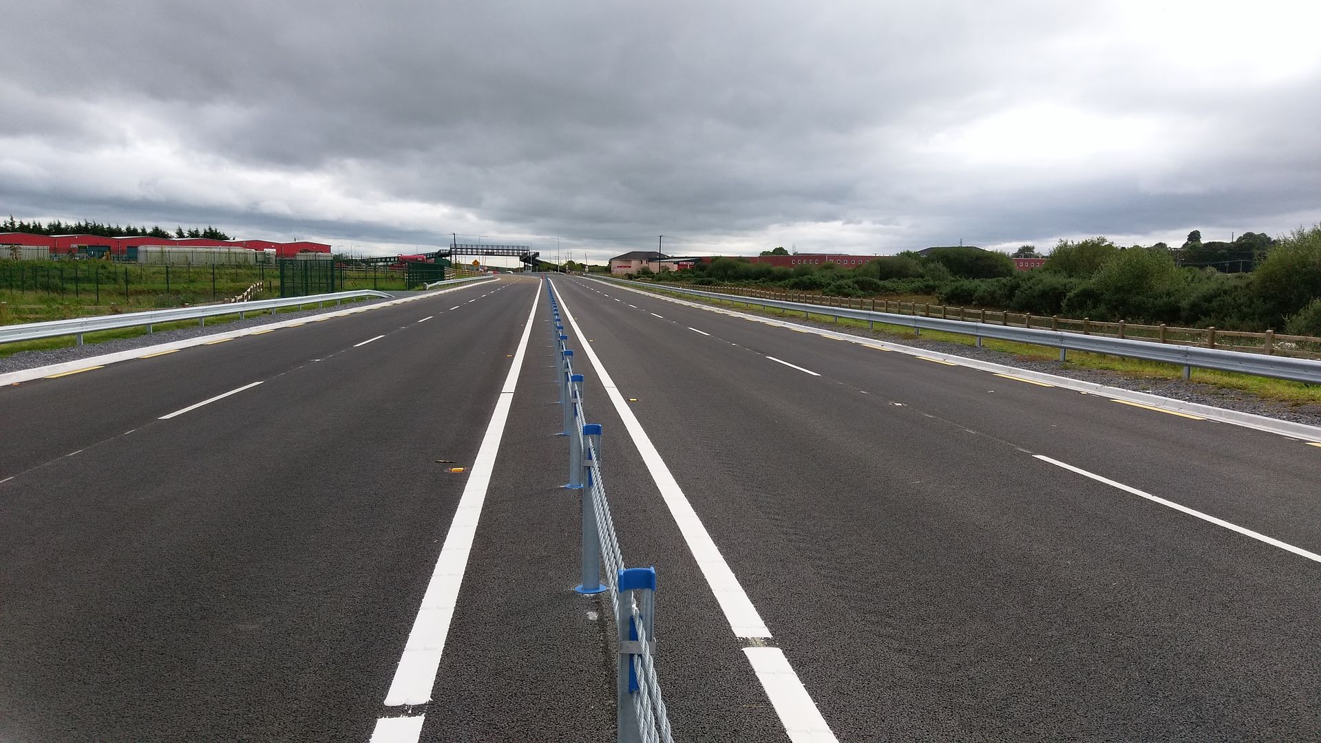
    2+2 is two lanes each way, no hard shoulder and a wire fence center barrier.


  • Registered Users Posts: 667 ✭✭✭BelfastVanMan


    With additional localised widening to accomodate hard shoulders, and full grade seperation of all junctions, then, yes.
    Theoretically.


  • Registered Users Posts: 4,321 ✭✭✭m17


    Reuben1210 wrote: »
    So 2+2 is standard enough dualler? Can it be easily upgraded to motorway at a later time if needed?

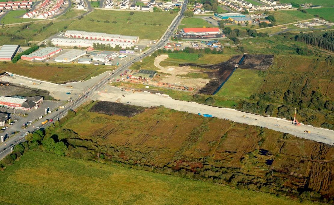
    It will be a continuation of the tuam bypassIMAG2220_zpsz44z89wm.jpg


  • Moderators, Science, Health & Environment Moderators Posts: 19,695 Mod ✭✭✭✭Sam Russell


    m17 wrote: »
    It will be a continuation of the tuam bypassIMAG2220_zpsz44z89wm.jpg

    Oh, why did they put roundabouts at each end of the Tuam bypass? A seamless connection of the M17 to Tuam bypass would have been so much better.


  • Registered Users Posts: 239 ✭✭sonnyblack


    irishgeo wrote: »
    i am curious how you think milltown and ballindine have more traffic. The same amount of traffic is still that n17 as was on it before the motorway opened.
    I don't agree. Traffic volumes would have been funneled out a bit coming through Claregalway previously. Also most people used to go into Galway and head out the N84 to travel onwards to Mayo are now using the new road and are dumped onto the Tuam Claremorris road together having travelled at speed on the new motorway and dual carriageway.


  • Registered Users Posts: 4,321 ✭✭✭m17


    Oh, why did they put roundabouts at each end of the Tuam bypass? A seamless connection of the M17 to Tuam bypass would have been so much better.

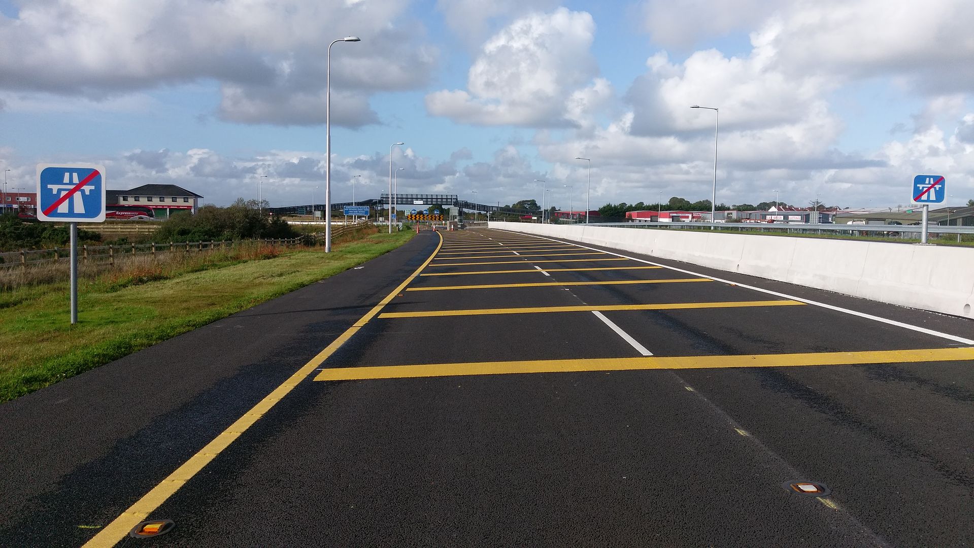
    End of the m17 and the start of the tuam bypass 10/08/15IMAG7022_zpsiqkzcgm3.jpg25/09/17IMAG2471_zpstu88qaz9.jpg


  • Advertisement
  • Registered Users Posts: 192 ✭✭ELCAT2009


    Oh, why did they put roundabouts at each end of the Tuam bypass? A seamless connection of the M17 to Tuam bypass would have been so much better.

    If i recall the preferred emergeing route between Tuam and Claremorris will connect into the Tuam by pass half way along it rather than at the roundabout at the end of the milltown road. I would have thought they would have planned for this junction however it is formed when the tuam by pass was being built to minimise disruption to traffic on the by pass. Not sure if it will be a roundabout again or a continuation with slip roads on / off the existing bypass.


  • Registered Users Posts: 48 remfan


    New road is now on Google maps but the section from Rathmorrisey to Gort is labelled M17


  • Registered Users Posts: 4,321 ✭✭✭m17


    remfan wrote: »
    New road is now on Google maps but the section from Rathmorrisey to Gort is labelled M17

    Welcome to two days ago


  • Registered Users Posts: 4,705 ✭✭✭serfboard


    ELCAT2009;105147616

            Sam Russell;105144727Oh, why did they put roundabouts at each end of the Tuam bypass?  A seamless connection of the M17 to Tuam bypass would have been so much better.


        If i recall the preferred emergeing route between Tuam and Claremorris will connect into the Tuam by pass half way along it rather than at the roundabout at the end of the milltown road. I would have thought they would have planned for this junction however it is formed when the tuam by pass was being built to minimise disruption to traffic on the by pass. Not sure if it will be a roundabout again or a continuation with slip roads on / off the existing bypass.

    ?

    I think Sam Russell was more asking about the Kilmore (southern) roundabout than the Mountpotter one, and I'd agree - when driving it you wonder why they didn't continue the motorway onto the bypass and terminate it at Mountpotter.

    Two possible reasons I can think of:

    1. Money. 2+2 is cheaper, and its cheaper to build a roundabout than a GSJ.

    2. Lobbying by local politicians. I can't say for sure about this, but this is nearly always the case for any bypass - local politicians lobby for a roundabout instead of a GSJ because they think that a roundabout will force more people to come into a town.


  • Registered Users Posts: 48 remfan


    m17 wrote: »
    remfan wrote: »
    New road is now on Google maps but the section from Rathmorrisey to Gort is labelled M17

    Welcome to two days ago
    thanks for the welcome, being new to this I didn't read the 6000+ posts and 557 pages before I dared to comment - I better get myself a PhD in Boards etiquette I guess


  • Registered Users Posts: 2,191 ✭✭✭MBSnr


    ^^^
    Google maps still not showing traffic info for the new route. Another layer to enable I guess....
    (Plus the already mentioned wrong labelling etc).


  • Registered Users Posts: 109 ✭✭Roadfan


    https://www.google.ie/url?sa=t&source=web&rct=j&url=https://www.irishtimes.com/business/technology/eircode-now-compatible-with-google-maps-1.3277851&ved=0ahUKEwjX6djQuKDXAhUmJcAKHRwiCekQxfQBCCkwBA&usg=AOvVaw0ECKQmGd3puQ6uqTYTBZYv

    Hope the link works. A bit off topic but users of Google maps might be interested to know that eircode is now compatible with the said maps. Interesting comments about increased traffic flows on route. Always wondered what impact there would be on Milltown Ballindine especially that school in Milltown. Bright side is that FRANK McDonald can't make any more claims about ghost motorway. A general thanks to all for posts . Been away myself . Hope Paul's ankle is mending well.


  • Registered Users Posts: 2,088 ✭✭✭Reputable Rog


    Travelled the M18 yesterday and today, first impressions is that it seems very narrow compared to the Shannon to Dromoland section.
    Signposting is poor, particularly at the Rathmorrisey interchange and the turn for Limerick is quite tight.
    All in all impressed, 40 minutes from Doughiska to McDonalds in Shannon, reckon I would have hit Coonagh in a similar time if I'd kept going, if it wasn't for the roadworks I reckon I could have done City Centre to City Centre in an hour if I was doing that journey.


  • Registered Users Posts: 4,321 ✭✭✭m17


    Travelled the M18 yesterday and today, first impressions is that it seems very narrow compared to the Shannon to Dromoland section.
    Signposting is poor, particularly at the Rathmorrisey interchange and the turn for Limerick is quite tight.
    All in all impressed, 40 minutes from Doughiska to McDonalds in Shannon, reckon I would have hit Coonagh in a similar time if I'd kept going, if it wasn't for the roadworks I reckon I could have done City Centre to City Centre in an hour if I was doing that journey.
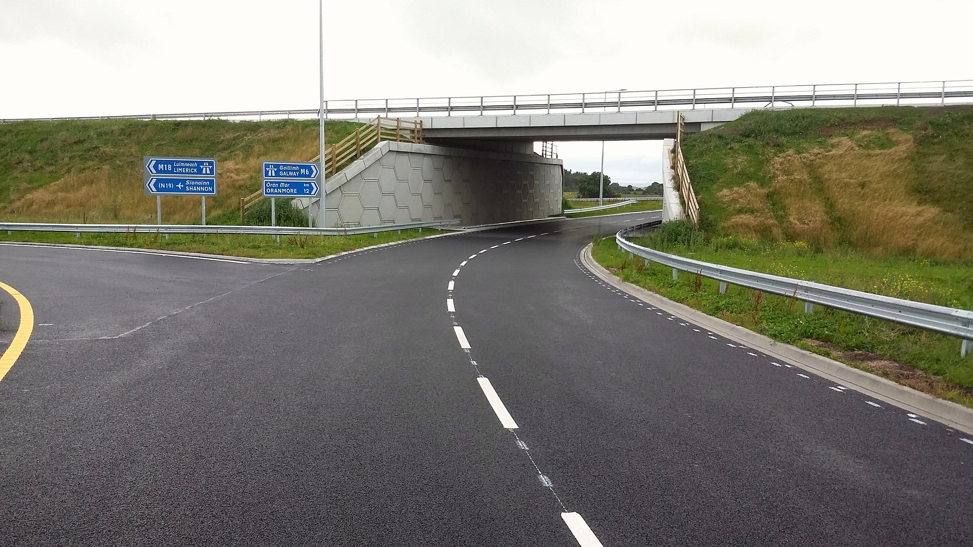
    the exit is really tight if you're an arctic driver and the lighting is also very poor for one of the biggest roundabouts in the country2017-08-25_02-04-23_zpsgnc4mnln.jpg


  • Advertisement
  • Registered Users Posts: 1,098 ✭✭✭glineli


    m17 wrote: »
    the exit is really tight if you're an arctic driver and the lighting is also very poor for one of the biggest roundabouts in the country2017-08-25_02-04-23_zpsgnc4mnln.jpg

    I met someone reversing against me last week. Instead of going all the way around they decided to reverse.

    It's a tough junction to navigate first time around with those sharp exits


Advertisement