Advertisement
If you have a new account but are having problems posting or verifying your account, please email us on hello@boards.ie for help. Thanks :)
Hello all! Please ensure that you are posting a new thread or question in the appropriate forum. The Feedback forum is overwhelmed with questions that are having to be moved elsewhere. If you need help to verify your account contact hello@boards.ie

Collins Road Atlas (Touring Edition 2010)

Options
  • 02-02-2010 5:38pm
    #1
    Closed Accounts Posts: 6,093 ✭✭✭


    Some excerpts from the new atlas, on sale now.

    DSCF0719.jpg

    DSCF0720.jpg

    DSCF0722.jpg

    DSCF0723.jpg

    DSCF0724.jpg

    DSCF0725.jpg

    DSCF0726.jpg

    DSCF0727.jpg

    DSCF0728.jpg

    DSCF0729.jpg

    DSCF0730.jpg

    DSCF0731.jpg

    DSCF0732.jpg

    All in all, a very good effort and a pleasure to see a mapping company actually pre-empting openings rather than playing catch up.


«1

Comments

  • Registered Users Posts: 2,091 ✭✭✭marmurr1916


    Looks good. I like the way they show the changes between ex-national road numbers and regional road numbers.


  • Registered Users Posts: 68,550 ✭✭✭✭L1011


    Few wee bits of jumping the gun a bit too much, but likely to be the most up-to-date atlas for a good few months to come anyway.


  • Banned (with Prison Access) Posts: 8,632 ✭✭✭darkman2


    Cheers Furet. Looks good. Any chance you could sneak in a pic of the map that shows an overall view of the country? I think it is is normally near the first couple of pages. That map really shows how close the M2,3,4 really are too each other.


  • Closed Accounts Posts: 6,093 ✭✭✭Amtmann


    Darkman: No problem. The country is divided between two pages.

    DSCF0742.jpg
    DSCF0741.jpg


  • Banned (with Prison Access) Posts: 8,632 ✭✭✭darkman2


    Bloody hell, 3 or 4 years ago there was hardly any blue on that map! It looks brilliant now. It's not just the roads themselves but it gives a good image because when tourists come they buy those maps and they will think to themselves - there is a good motorway network here in Ireland.;)


    However it does clearly show that there is a North/South divide. Although maybe circumstances mean that has to be the case given the smaller places to the North.


  • Advertisement
  • Registered Users Posts: 1,204 ✭✭✭dave 27


    theres a motorway between ennis and limerick..not a dual carrageway!


  • Closed Accounts Posts: 430 ✭✭Steviemak


    Thanks Furet. Great to see the network coming together so well.


  • Registered Users Posts: 262 ✭✭citycentre


    dave 27 wrote: »
    theres a motorway between ennis and limerick..not a dual carrageway!

    It's only a dual carriageway beyond Shannon and will be for some time to come due to the number of too-tight bends, at grade junctions and the roller coaster-esque surface. To make a motorway between Shannon and Limerick would almost require a completely new alignment...


  • Closed Accounts Posts: 4 jawantyergoboy


    BTH wrote: »
    It's only a dual carriageway beyond Shannon and will be for some time to come due to the number of too-tight bends, at grade junctions and the roller coaster-esque surface. To make a motorway between Shannon and Limerick would almost require a completely new alignment...


    Totally agree. I live in Limerick and work in Shannon. Its barely DC standard never mind motorway standards, - between the near parabolic bends and numerous houses with direct access onto the road and the "coaster-esque" surface - you'd nearly be nauseous arriving in work :(


  • Registered Users Posts: 89 ✭✭oddiot


    Looks well, thanks Furet. I know it's nitpicking, but it does show a tolled motorway section between exits 14 and 15 of the M6 (Balinasloe bypass), but on the whole it's great :D


  • Advertisement
  • Registered Users Posts: 5,886 ✭✭✭Chris_5339762


    Crosspost of my rant from Sabre :D

    I saw it the other day and I think the number of mistakes is embarassing. If they spent 5 minutes driving they would know that loads of the new roads are wrongly marked.

    eg:
    M7 near Limerick not open
    M18 from Gort to M6 is not under construction, and the fact that the M17 from M6 to Tuam is not shown means they dont know whats happening.
    The M9 isnt finished.
    M6 isnt M6 near Doughiska, its N6.
    M3 isnt open

    And even if by "Atlas 2010" they mean "what will be open at end 2010" its still wrong!

    OSM is still more accurate :D


  • Closed Accounts Posts: 3,010 ✭✭✭Tech3


    Ok some schemes should not be down as completed particularly the two M9 schemes. I guess Nenagh to Limerick is going to partially open in a few weeks so they can get away with that. Overall it shows how far the network has come from a couple of years ago.

    Cheers for the pics Furet!


  • Registered Users Posts: 2,278 ✭✭✭mackerski


    My own nit-pick here is the N10, which is shown as all-purpose road, even though it will lead inescapably to a motorway.


  • Registered Users Posts: 368 ✭✭Roryhy


    mackerski wrote: »
    My own nit-pick here is the N10, which is shown as all-purpose road, even though it will lead inescapably to a motorway.

    I saw it on an official map described as same so i wouldn't blame the Collins people for that.

    I also see they have speed cameras marked on the n2 at least.

    What do the black dotted sections of road represent? heavy traffic, twisty, narrow? i cant quite figure it....

    Also note the n78 Athy link road is now marked in.

    Nice to see the Tullamore bypass there too!


  • Closed Accounts Posts: 6,093 ✭✭✭Amtmann


    Roryhy wrote: »
    I saw it on an official map described as same so i wouldn't blame the Collins people for that.

    I also see they have speed cameras marked on the n2 at least.

    What do the black dotted sections of road represent? heavy traffic, twisty, narrow? i cant quite figure it....

    Also note the n78 Athy link road is now marked in.

    Nice to see the Tullamore bypass there too!

    The black dots signify a known Garda tendency to lurk with hairdryers in hand.

    I think it's a very good map. And in fairness they have marked the motorways with white boxes to show roads not yet open. High tourist season is July and August, don't forget, and the map is actually a touring edition, aimed at that market. So I think Collins were right to include as yet incomplete motorways, because by July the lion's share of them will have opened.


  • Registered Users Posts: 369 ✭✭Empire o de Sun


    2011 should be cool then.

    just the M17 being built is it in 2011?

    oops, I mean the M18


  • Registered Users Posts: 1,495 ✭✭✭AlanD


    A glaring omission, not from the map, but from a planning point of view is Limerick - Waterford road....I'm sure there are others, but what an awful awful road this is.

    I'd nearly travel up the M7 and down the M9 (when all complete) than do that journey.


  • Registered Users Posts: 3,105 ✭✭✭hi5


    mackerski wrote: »
    My own nit-pick here is the N10, which is shown as all-purpose road, even though it will lead inescapably to a motorway.

    And my nit-pick is that nobody refers to Paulstown(m9-Kilkenny) as Whitehall so why do maps insist on doing so.


  • Registered Users Posts: 4,148 ✭✭✭rameire


    any chance you could take a pic of each page individually.

    so i can print them all out and make up my own atlas of ireland and sell them to boardsies for a fiver.

    🌞 3.8kwp, 🌞 Split 2.28S, 1.52E. 🌞 Clonee, Dub.🌞


  • Registered Users Posts: 5,886 ✭✭✭Chris_5339762


    2011 should be cool then.

    just the M17 being built is it in 2011?

    oops, I mean the M18

    M17/18 should start early 2011 and so should the N7 Newlands / M11 gap PPPs. Provided both can get funding.


  • Advertisement
  • Closed Accounts Posts: 5,133 ✭✭✭mysterious


    We should get Phase 1 of the M20 and Adare bypass before the other schemes of the N11.

    I'm sorry but I'm not accepting this carry on, of pushing other schemes over others more in need.


  • Closed Accounts Posts: 5,133 ✭✭✭mysterious


    AlanD wrote: »
    A glaring omission, not from the map, but from a planning point of view is Limerick - Waterford road....I'm sure there are others, but what an awful awful road this is.

    I'd nearly travel up the M7 and down the M9 (when all complete) than do that journey.

    Actually you could make a great run, if they kept the M7 junction just after the M7/M8 where you could down the R434 onto Durrow, I wanted this road dto be renamed the N77 and the N77 upgraded and scrapped either an M11 or M9.


  • Registered Users Posts: 5,886 ✭✭✭Chris_5339762


    I'd put the M11 gap ahead of the M20 as its a lethal bit of road. I know the M20 is too, but at least you're slow the whole way, not a bit of crap road between two 120kmh sections.

    Newlands + M11 should arguably be before the M17/18.


  • Registered Users Posts: 64 ✭✭paddy cork


    how much is it and has anyone seen it discounted anywhere


  • Registered Users Posts: 1,241 ✭✭✭baalthor


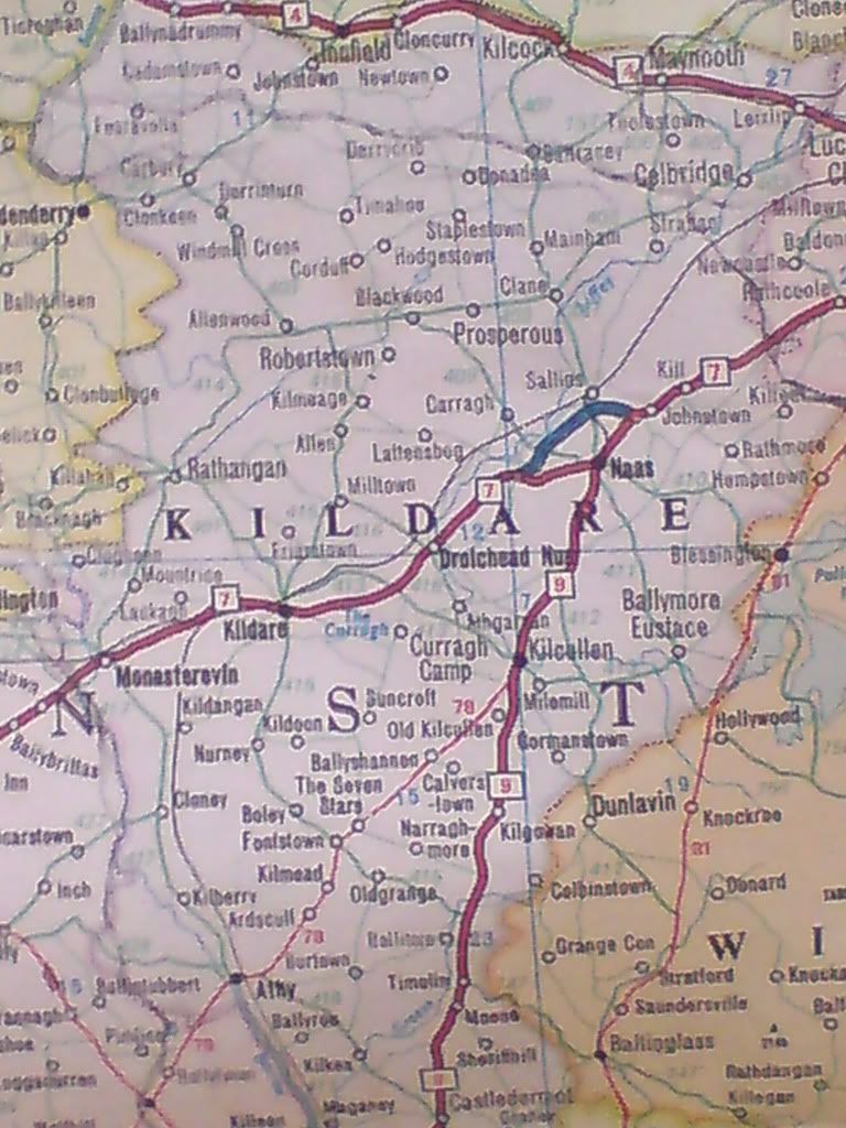
    Just for comparison, here is the Republic's Motorway "network" on my 1986 Geographica map:

    DSC00089.jpg


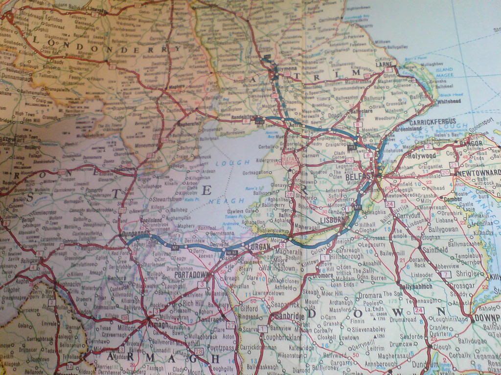
    And here is the 1986 NI network:

    DSC00091.jpg


  • Registered Users Posts: 8,779 ✭✭✭Carawaystick


    M17/18 should start early 2011 and so should the N7 Newlands / M11 gap PPPs. Provided both can get funding.
    Just ask Anglo Irish for 0% finance and it'll blow all my complaints about ppp's outta da water...

    Anyway much as I'd like to see the M11 gap closed, I don't think it is bad safety wise, the Motorway changes to DC, then WS2 before the narrow bit, allowing motorists gradually adjust.

    A lot of the deaths on this bad section of the N11 were due to multivehicle multi-occupant deaths, in relatively few accidents, one with a failed prosecution killed 6 on a minibus, and another where joyriders killed themselves and a senator. and another death took place on a bendy section that has been replaced.

    The main issue is the capacity of the road is too low for the traffic.


    The N20 is criminally bad for an intercity route.


  • Registered Users Posts: 68,550 ✭✭✭✭L1011


    Pity that 1986 map doesn't have DCs on it or it'd have looked a *little* healthier on the "7" as it calls it - city all the way to the east of Newbridge and another patch between Newbridge and Kildare were there by 1986.


  • Moderators, Science, Health & Environment Moderators Posts: 16,838 Mod ✭✭✭✭Gonzo


    those 1986 maps really go's to show how far we've come with our motorways and how little has been achieved in NI with motorways since the 80s.


  • Registered Users Posts: 68,550 ✭✭✭✭L1011


    Gonzo wrote: »
    how little has been achieved in NI with motorways since the 80s.

    Right down to the "under construction" section on the 1986 map not only only not being built but being completely cancelled at this stage!


  • Advertisement
  • Registered Users Posts: 7,476 ✭✭✭ardmacha


    here is the Republic's Motorway "network" on my 1986 Geographica map:

    Ah now you are being very harsh, the network was almost twice that size, where was the M1 to the airport!
    Right down to the "under construction" section on the 1986 map not only only not being built but being completely cancelled at this stage!

    Any map that fails to show duallers would put NI in a bad light.


Advertisement