Advertisement
If you have a new account but are having problems posting or verifying your account, please email us on hello@boards.ie for help. Thanks :)
Hello all! Please ensure that you are posting a new thread or question in the appropriate forum. The Feedback forum is overwhelmed with questions that are having to be moved elsewhere. If you need help to verify your account contact hello@boards.ie

Seen & Found

Options
1222325272832

Comments

  • Registered Users Posts: 6,561 ✭✭✭JJayoo


    Some bog Oak with what appears to be axe marks.

    There is a huge amount of big Oak in this area, and giant mounds of it were but t when land owners father was digging drains with digger.

    Could these marks be very old and perhaps done when chopping the tree down?

    Just to the left of this chunk is a long narrow length of big Oak


  • Registered Users Posts: 135 ✭✭mocmo


    I don't think these are axe marks but rather the trunk is splitting along the natural lines (medullary rays) within the oak, which are straight and so give the impression of being cut marks.

    I've seen this before on bog oak which breaks along these lines into what look like planks and/or cut pieces of wood but are in fact totally natural.

    Felled and worked tree trunks or stumps are occasionally found along bog margins though.


  • Moderators, Science, Health & Environment Moderators Posts: 5,220 Mod ✭✭✭✭slowburner


    Does anyone know if the oblique imagery on Bing is going to be available in future for non-urban areas, or is it is a thing of the past?


  • Moderators, Science, Health & Environment Moderators Posts: 5,220 Mod ✭✭✭✭slowburner


    Great resource for the aerial enthusiast...https://www.cambridgeairphotos.com/
    AKA the CUCAP collection.


  • Moderators, Science, Health & Environment Moderators Posts: 5,220 Mod ✭✭✭✭slowburner


    The Geological Survey of Ireland made (some) LIDAR data sets available on the 24th of April. Over 200 'new' sites have already been identified by one enthusiast in one county. Hopefully more data sets will be added in future.
    The mapviewer is available here


  • Advertisement
  • Registered Users Posts: 719 ✭✭✭12 element


    slowburner wrote: »
    The Geological Survey of Ireland made (some) LIDAR data sets available on the 24th of April. Over 200 'new' sites have already been identified by one enthusiast in one county. Hopefully more data sets will be added in future.
    The mapviewer is available here

    Does this look like a new find:

    449573.jpg

    (circle in the middle!)


  • Registered Users Posts: 1,454 ✭✭✭bogwalrus


    12 element wrote: »
    Does this look like a new find:

    449573.jpg

    (circle in the middle!)

    Only circle I see is the "O" in the "Osi" watermark on the map.


  • Registered Users Posts: 7,410 ✭✭✭jmcc


    12 element wrote: »
    Does this look like a new find:

    449573.jpg

    (circle in the middle!)
    Not in any way an expert on this but it looks unusual. The other circles seem to be natural features or pits or quarries.

    Regards...jmcc


  • Registered Users Posts: 7,410 ✭✭✭jmcc


    slowburner wrote: »
    Looks very much like a barrow. Worth notifying the NMS.
    Yep. There also seems to be an older field/boundary system (or tracks) in the lidar image. Some of the more recent fields follow the older lines the field/region with what could be a barrow also has a few linear ridges/tracks. Most of the other fields don't have that same concentration. It could just be an older field system but there's a depression/pit. If that was dug or quarried historically, then there might have been evidence of it being worked.

    There's also a feint trace of the possible barrow in the visual spectrum/colour image.

    Regards...jmcc


  • Moderators, Science, Health & Environment Moderators Posts: 5,220 Mod ✭✭✭✭slowburner


    12 element wrote: »
    Does this look like a new find:

    449573.jpg

    (circle in the middle!)
    Yes it does. It looks like a ring barrow and should be notified to the NMS.


  • Advertisement
  • Registered Users Posts: 485 ✭✭Wildlife Actor


    https://www.google.ie/amp/s/www.irishtimes.com/news/environment/permission-granted-for-office-development-at-screen-cinema-site-1.3335731%3fmode=amp

    I think the planning is appealed to an bord pleanala but if its granted they will be digging up where it's reputed the long stone may be buried. Locals of this parish will probably be more familiar with the long stone than me but as far as I know it disappeared around the time the land in that area was made up for the quays in the 17th century.

    Are the archaeological surveys done on behalf of developers done with as much rigour as "normal" ones?


  • Moderators, Science, Health & Environment Moderators Posts: 5,220 Mod ✭✭✭✭slowburner


    Are the archaeological surveys done on behalf of developers done with as much rigour as "normal" ones?

    By 'normal', I assume you mean research excavation.
    Research excavations differ from professional excavations in a number of ways. For example; research excavations usually have a major teaching element, or community involvement. This usually means that a number of the diggers have no experience in excavation. Things generally move along at a much slower pace because people need to be taught how to do the work.
    The fact that professional archaeologists are excavating and recording every working day means that they are also capable of meeting the strenuous physical and intellectual demands, and they are capable of excavating at a pace that far exceeds the abilities of non-professionals.
    Your concerns are understandable, but the short answer is yes - the excavation will be carried out with every bit as much rigour.


  • Registered Users Posts: 441 ✭✭forgottenhills


    I often trek around Coillte woods in the Dublin/Wicklow mountains and keep my eyes open for anything unusual.

    Last month I was walking on a hillside looking down a slope to a river in a scenic area where there are various walking paths. At the top of the slope the rough overgrown field leading down to the river meets up with a wood and levels off. There are a lot of stones under the trees at the edge of this wood where it meets the field. There was one stone sticking up out of the ground at an angle that caught my eye. It is obviously an old carved stone with a round hole made all the way through it near the top of the stone.

    Now my first thought was that this is an old carved gate post as I have seen a few of these here and there up the Wicklow hills. But usually they occur in pairs and on this occasion I could only see one. Also their edges are usually sharper which might suggest that either the stone I came across is older and its edges have been rounded by age or was carved from a softer stone than other posts.

    Within 20 yards of this stone, almost completely hidden by the wood are old stone walls that are very roughly built and don’t look like the ruins of an old cottage or church (unless a very makeshift construction without windows), more like rough walls built to hold sheep or for some similar use. I don't see any archaeology marked on the maps in this exact area although there is something marked less than half a mile away.

    I have attached a link to 2 pics of this leaning stone. You can see the field boundary near to the stone with a bit of old netting wire under the stone. What do people think? Is this simply an old gate post? I don't have any great knowledge of archaeology but I have a vague memory of reading sometime that some standing stones have been recorded that had a hole through them like the one that I came across.

    aqxiVaD

    https://imgur.com/a/aqxiVaD


  • Moderators, Science, Health & Environment Moderators Posts: 5,220 Mod ✭✭✭✭slowburner


    I often trek around Coillte woods in the Dublin/Wicklow mountains and keep my eyes open for anything unusual.

    Last month I was walking on a hillside looking down a slope to a river in a scenic area where there are various walking paths. At the top of the slope the rough overgrown field leading down to the river meets up with a wood and levels off. There are a lot of stones under the trees at the edge of this wood where it meets the field. There was one stone sticking up out of the ground at an angle that caught my eye. It is obviously an old carved stone with a round hole made all the way through it near the top of the stone.

    Now my first thought was that this is an old carved gate post as I have seen a few of these here and there up the Wicklow hills. But usually they occur in pairs and on this occasion I could only see one. Also their edges are usually sharper which might suggest that either the stone I came across is older and its edges have been rounded by age or was carved from a softer stone than other posts.

    Within 20 yards of this stone, almost completely hidden by the wood are old stone walls that are very roughly built and don’t look like the ruins of an old cottage or church (unless a very makeshift construction without windows), more like rough walls built to hold sheep or for some similar use. I don't see any archaeology marked on the maps in this exact area although there is something marked less than half a mile away.

    I have attached a link to 2 pics of this leaning stone. You can see the field boundary near to the stone with a bit of old netting wire under the stone. What do people think? Is this simply an old gate post? I don't have any great knowledge of archaeology but I have a vague memory of reading sometime that some standing stones have been recorded that had a hole through them like the one that I came across.

    aqxiVaD

    https://imgur.com/a/aqxiVaD

    It’s quite definitely a gate post. They don’t necessarily have to occur in pairs. Often, one or both are re-used.


  • Registered Users Posts: 441 ✭✭forgottenhills


    slowburner wrote: »
    It’s quite definitely a gate post. They don’t necessarily have to occur in pairs. Often, one or both are re-used.

    It probably is just an old post but the curiosity I had about it was fueled by the following:
    • the stone is in a highly scenic/strategic hillside area overlooking a river approx 100 metres below
    • it seems to be located on a mound of stones
    • it doesn't look to be in a natural place to be an opening to a field or a laneway unless these boundaries were very long ago and have long disappeared. Also it seems a little shorter than I would expect for a gate post.
    • there is the curious cluster of roughly built stone walls close by in the shape of old shed or house walls, semi-collapsed but with no evidence of windows and or roofs. It was these that first drew my attention as I was walking on an ascending path in the woods close by and could see them half -hidden below me in the trees at the edge of the wood.


  • Moderators, Science, Health & Environment Moderators Posts: 5,220 Mod ✭✭✭✭slowburner


    It probably is just an old post but the curiosity I had about it was fueled by the following:
    • the stone is in a highly scenic/strategic hillside area overlooking a river approx 100 metres below
    • it seems to be located on a mound of stones
    • it doesn't look to be in a natural place to be an opening to a field or a laneway unless these boundaries were very long ago and have long disappeared. Also it seems a little shorter than I would expect for a gate post.
    • there is the curious cluster of roughly built stone walls close by in the shape of old shed or house walls, semi-collapsed but with no evidence of windows and or roofs. It was these that first drew my attention as I was walking on an ascending path in the woods close by and could see them half -hidden below me in the trees at the edge of the wood.
    If you look closely, you will notice a scalloped effect on the arris of the post. This is known colloquially as ‘stone stitching’. This effect is the remaining evidence for how the stone was initially shaped. This kind of stone-cleaving is typically associated with post-Medieval activity.
    I can assure you that this is a gate post. It received the bolt. Much of it may be below ground now but if not, its size does not matter: gates can be a variety of dimensions.
    The post does however, hint that the surrounding stones were once part of a structure. Possibly a sheep fold.
    It would be worthwhile to check the historic mapping on the OSI website for C.19th buildings.


  • Registered Users Posts: 1,454 ✭✭✭bogwalrus


    This symbol is carved into a stone that is part of a very old stone building in the countryside of macroom. Across the road there is a dolmen in a field. Any ideas as to what the symbol is for and how old it might be? I'll try get a better pic when I am up there again.

    https://drive.google.com/file/d/1okUKVSnQ7BPhdlVnoz2lavWWtW_C0nSW/view?usp=drivesdk


  • Moderators, Science, Health & Environment Moderators Posts: 5,220 Mod ✭✭✭✭slowburner


    bogwalrus wrote: »
    This symbol is carved into a stone that is part of a very old stone building in the countryside of macroom. Across the road there is a dolmen in a field. Any ideas as to what the symbol is for and how old it might be? I'll try get a better pic when I am up there again.

    https://drive.google.com/file/d/1okUKVSnQ7BPhdlVnoz2lavWWtW_C0nSW/view?usp=drivesdk
    It’s an Ordnance Survey benchmark.
    The survey started around 1837. If you check the historic maps, you will see it depicted at the precise location.
    If it’s on the historic 6”, then it’s from the first survey (circa 1838 - 1843). If it’s on the historic 25”, then it’s circa 1860 - 1911.


  • Moderators, Science, Health & Environment Moderators Posts: 5,220 Mod ✭✭✭✭slowburner


    OS benchmarks were precise points recording height over datum (above the ordinary low water mark at sea level).
    They are still useful today.
    The accuracy of the two surveys is still remarkable and reliable. Most of the measurements were taken by two sappers laying out chains. Not much room for error there!


  • Registered Users Posts: 1,454 ✭✭✭bogwalrus


    slowburner wrote: »
    OS benchmarks were precise points recording height over datum (above the ordinary low water mark at sea level).
    They are still useful today.
    The accuracy of the two surveys is still remarkable and reliable. Most of the measurements were taken by two sappers laying out chains. Not much room for error there!

    Awesome. That's all very interesting. It was my neighbour who told me about it and has no clue what it is. He will love this piece of info as I'd say it has bothered him for years.


  • Advertisement
  • Moderators, Science, Health & Environment Moderators Posts: 5,220 Mod ✭✭✭✭slowburner


    An archaeologist (Ivor Kenny) working for Archaeology & Built Heritage in Dublin recovered an intact Medieval jug earlier this month.
    The jug is classed as Dublin Ware, and it dates from the late 13th to early 14th centuries. The find site was close to Dublin Castle, I understand.
    The discovery is remarkable because the jug remained intact for upwards of seven hundred years at the base of a refuse pit in one of the most active, and densely populated parts of the city.
    To put it in perspective; the jug was probably contemporary with the establishment of Ireland's first parliament (1297) and the Black Death (1314).

    459341.jpg


  • Registered Users Posts: 1,021 ✭✭✭Coles


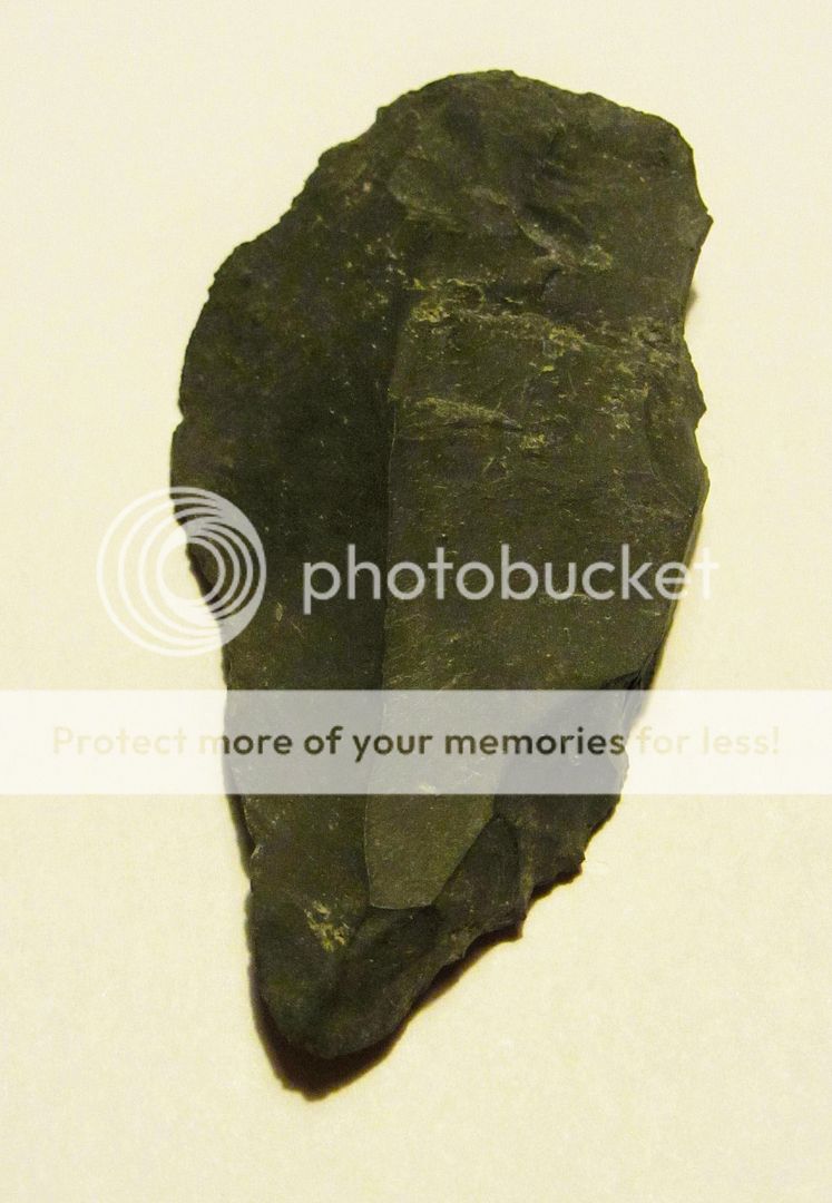
    Some possibly Mesolithic tools found in Co. Wicklow.

    86a87869-ce01-4a32-9455-a7de8582cad1-original.jpg?width=1920&height=1080&fit=bounds


  • Moderators, Science, Health & Environment Moderators Posts: 5,220 Mod ✭✭✭✭slowburner


    The lower two have some of the diagnostic elements of struck lithics but I would not be convinced. The upper two are more doubtful.
    What is the lithology and what are the dimensions?


  • Registered Users Posts: 17,935 ✭✭✭✭Thargor


    Coles wrote: »
    Some possibly Mesolithic tools found in Co. Wicklow.

    86a87869-ce01-4a32-9455-a7de8582cad1-original.jpg?width=1920&height=1080&fit=bounds[IMG][/img]

    You found them? Just lying on the ground or at some site?


  • Registered Users Posts: 1,021 ✭✭✭Coles


    slowburner wrote: »
    The lower two have some of the diagnostic elements of struck lithics but I would not be convinced. The upper two are more doubtful.
    What is the lithology and what are the dimensions?
    Thanks for the reply.

    Here's some more detail of the two blades. Both have nice bulbs of percussion, reworkings etc. The pointed one is 88mm x 42mm, the parallel edged blade is 70mm x 32mm.

    6fbe49b1-5ef3-41b6-8c59-725262eda1a2-original.jpg?width=1920&height=1080&fit=bounds

    96407893-fff4-47a6-b85c-7b689ca60c39-original.jpg?width=1920&height=1080&fit=bounds

    bd9753ad-e554-4419-ad84-891ff1e85f22-original.jpg?width=1920&height=1080&fit=bounds

    b0c938f2-1bdc-428c-a449-97213ccc8b9e-original.jpg?width=1920&height=1080&fit=bounds

    A nearby location has also turned up some nice neolithic convex scrapers, sharpening stones etc.

    70401d51-6c93-4fcc-a388-eea1840726ad-original.jpg?width=1920&height=1080&fit=bounds

    cbec96fe-cc46-4d9c-8aa2-045e9f206166-original.jpg?width=1920&height=1080&fit=bounds

    I won't be revealing the location on a public forum.


  • Moderators, Science, Health & Environment Moderators Posts: 5,220 Mod ✭✭✭✭slowburner


    You are quite right to keep the location private but I am very familiar with it.


  • Registered Users Posts: 1,021 ✭✭✭Coles


    @slowburner. Yes, I suspected you might. My collection is available whenever a study is done of the area.


  • Registered Users Posts: 139 ✭✭Aelfric


    At least three of these lithics are diagnostically late Mesolithic, so you should report the finds, and their location, to the Duty Officer at the National Museum of Ireland if you haven't done so already.


  • Registered Users Posts: 17,935 ✭✭✭✭Thargor


    Wasn't asking for a location but whats the nature of the site? Is it well known? Cave or bog or something?


  • Advertisement
  • Moderators, Science, Health & Environment Moderators Posts: 5,220 Mod ✭✭✭✭slowburner


    Aelfric wrote: »
    At least three of these lithics are diagnostically late Mesolithic, so you should report the finds, and their location, to the Duty Officer at the National Museum of Ireland if you haven't done so already.

    What late Mesolithic diagnostic features do you see?
    I’m seeing maybe silicified limestone but definitely not chert.


Advertisement