Advertisement
If you have a new account but are having problems posting or verifying your account, please email us on hello@boards.ie for help. Thanks :)
Hello all! Please ensure that you are posting a new thread or question in the appropriate forum. The Feedback forum is overwhelmed with questions that are having to be moved elsewhere. If you need help to verify your account contact hello@boards.ie

Convective/Thunderstorm Discussion: Spring/Summer 2016

Options
1495052545558

Comments

  • Registered Users Posts: 187 ✭✭Lenny5


    https://twitter.com/independent_ie/status/755721336887078912

    My footage made it into independent 😬


  • Registered Users Posts: 5,068 ✭✭✭Iancar29


    The powerful updraft of the only surface based storm yesterday going up in an environment of roughly 2000j/kg of CAPE. Felt like I was back in the plains of the US yesterday.
    392247.jpg


  • Closed Accounts Posts: 3,047 ✭✭✭Clonmel1000


    Gonzo wrote: »
    lets face it, Ireland and thunderstorms are just never meant to be!

    Same as Ireland with snow or Ireland with hot warm weather for any more than 2 days


  • Closed Accounts Posts: 3,047 ✭✭✭Clonmel1000


    Lenny5 wrote: »
    https://twitter.com/independent_ie/status/755721336887078912

    My footage made it into independent 😬

    Heatwave? Another misleading headline. Fantastic video though fair play for sharing.


  • Registered Users Posts: 12,179 ✭✭✭✭Grandeeod


    Its on days like this I really appreciate witnessing the "big ones" in '85 and '86. I was also fortunate enough to witness the big one in Tenerife, December 2013.


  • Advertisement
  • Registered Users Posts: 619 ✭✭✭vistafinder


    Iancar29 wrote: »
    The powerful updraft of the only surface based storm yesterday going up in an environment of roughly 2000j/kg of CAPE. Felt like I was back in the plains of the US yesterday.

    Thats a great shot. Love looking at it.


  • Registered Users Posts: 7,196 ✭✭✭pad199207


    Heavy rain arriving later could give some Thundery Bursts in a few places.


  • Posts: 21,179 ✭✭✭✭ [Deleted User]


    Doesn't look heavy on the radar, just Mist to light to moderate and patchy.


  • Registered Users Posts: 20,362 ✭✭✭✭Rikand


    That line of heavy rain over athlone now.....

    52194219.jpg


  • Registered Users Posts: 554 ✭✭✭glightning


    Morning all. I've been a lurker on the boards and have decided to sign up and join in the craic :-)

    I'm a keen weather watcher from County Antrim and in particular love storms.

    I was very frustrated with the outcome the other day. I was very surprised that Met Eireann managed to call out the storm areas so well. I had been siding with the Beeb and UK Met Office advice the whole day as I was basing the expected storm coverage on the coarser resolution GFS output - which agreed with what those agencies were saying along with the analysis on various forums and websites such as ukconvectiveweather.

    It was one of those days with amazing amounts of potential that don't come along very often with CAPE of 1500 - 2000 j/kg and lifted index down to around -6 to -8. Such a waste that nothing fired over Ireland itself! It will surely be some time before we see CAPE values so good again on these shores.

    Looking back at the event using the finer resolution NMM model (and also the NetWx-SR based on NMM), it can be seen that that model had already called out the storm areas very well and it never included Ireland itself (the model in fact called out the actual storm areas very well).

    In fact, I even remember my concern building on the day when I saw the Met Office video with the interview of the guy in the Exeter office and it showed the Met Office's own mesoscale model animation in the background which again showed the precip in the right areas and nothing for Ireland itself. Even though he was going on about "severe storms in Northern Ireland". Clearly not following what his own weather model was showing!

    So the big question in my mind is this.. What aspect of the airmass sitting directly over us that caused the storms not to fire over the land (considering they fired all around us)? There must have been some low level CAP in place over Ireland itself because at the mid levels there was plenty of Ac Cas all day long suggesting mid level instability. Even with the CAP, I still don't understand why we didn't get elevated storms either.

    Moving forward, I will be relying on the finer resolution mesoscale models much more for events like this as they show the small scale differences in CAPE and LI between different locations far better which can be the difference between storms over your location or not. As an example, I used them yesterday during the short period of increased CAPE and LI over Northern Ireland and they called out the location of cells very accurately. We got one or two firing up in the exactly the modelled positions, but despite looking good with well defined anvils they did not become electrified (at least according to the lightning maps although they might have had an isolated IC or two that were not detected). But again, the setup was more marginal with only a few hundred CAPE available.

    So overall a huge bust for us I think. I felt like I had a huge hangover the next day as I couldn't get over the amazing opportunity we missed out on. But ho hum, life moves on!


  • Advertisement
  • Moderators, Home & Garden Moderators, Science, Health & Environment Moderators Posts: 17,984 Mod ✭✭✭✭DOCARCH


    Distant/muffled rumble of thunder here in Dublin 16.


  • Registered Users Posts: 554 ✭✭✭glightning


    Excellent. The Sat24 animation is showing a line of developing convective cloud west of Dublin which also appears to be further developing in the north midlands. Looking at the track, the northern end should come up to my location within the next hour or two. Hopefully catch a sferic or two if it does. Thought the cape is forecast to fall away possibly by the time it makes it up here. Just have to wait and see


  • Registered Users Posts: 6,257 ✭✭✭highdef


    glightning wrote: »
    Excellent. The Sat24 animation is showing a line of developing convective cloud west of Dublin which also appears to be further developing in the north midlands. Looking at the track, the northern end should come up to my location within the next hour or two. Hopefully catch a sferic or two if it does. Thought the cape is forecast to fall away possibly by the time it makes it up here. Just have to wait and see

    Just a a minute downpour near Enfield. Was sunny right up until it suddenly started and is sunny again now. Still very warm and humid. Rain was heavy enough to set off some alarms


  • Posts: 0 [Deleted User]


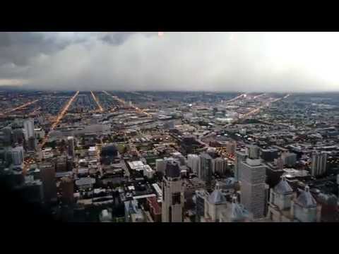
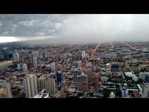
    BOOM!!!! Chicago a couple of days ago.


  • Registered Users Posts: 6,827 ✭✭✭fred funk }{


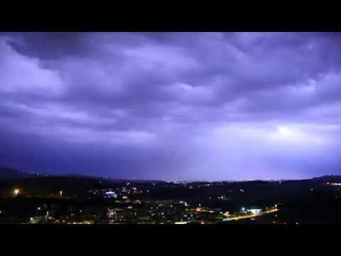
    On holidays in north Italy at the moment. Incredible thunder storm here the past few hours and slowly intensifying. The sky is literally flashing several times every second.


  • Posts: 21,179 ✭✭✭✭ [Deleted User]


    If it's that good make a few Videos. :)


  • Registered Users Posts: 6,827 ✭✭✭fred funk }{


    If it's that good make a few Videos. :)

    Already did. I'll stick them up when I'm home. Still going strong here, heavy rain and wind.


  • Posts: 21,179 ✭✭✭✭ [Deleted User]


    Met.ie forecast for the night. That's some rain up there.

    Met.jpg

    Radar

    met%202.jpg


  • Registered Users Posts: 352 ✭✭jfSDAS


    Apologies if this is a re-post. Just spotted the article below on the Guardian UK web site. Amazing photos of lightning, storms, and more from a US storm chaser.

    https://www.theguardian.com/us-news/gallery/2016/jul/28/jason-weingart-storm-chasing-in-pictures


  • Registered Users Posts: 554 ✭✭✭glightning


    On holidays in north Italy at the moment. Incredible thunder storm here the past few hours and slowly intensifying. The sky is literally flashing several times every second.

    I watched this storm live online last night via streaming webcams (from Lake Garda first of all and then Verona). It was going absolutely insane in Verona at midnight. I was watching the camera in the center of the city which points at the square, but you can see some sky and watch the lightning from there. A bonus with the Verona webcam was that I also had audio and could also hear the constant thunder. Seemed like a huge and vicious storm. Skyline Webcams website is great for watching storms on the continent. Lucky you got to see it in person! I was thinking to myself last night just how great it would be to actually be in Verona in person (I could see people in the town watching it).


  • Advertisement
  • Registered Users Posts: 554 ✭✭✭glightning


    YouTube video of the North Italy storm last night (taken from Verona) :-


    Search YouTube for this "Cella temporalesca su Verona"

    The forum throws an error if I try and paste the link

    Video is in realtime.


  • Posts: 21,179 ✭✭✭✭ [Deleted User]


  • Moderators, Home & Garden Moderators, Science, Health & Environment Moderators Posts: 17,984 Mod ✭✭✭✭DOCARCH


    glightning wrote: »
    YouTube video of the North Italy storm last night (taken from Verona)

    Put's Irish storms to shame. :(

    I stayed near Venice a couple of years ago, during the Summer, and had a view towards the Alps/Lake Garda...every evening you could see and amazing, but distant, light show in that direction.


  • Registered Users Posts: 554 ✭✭✭glightning


    Saw some good storms in Sorento, Italy a number of years back. All-nighter's. We had the bonus of being in a hotel high in the hills above Sorento with a great view to the north. Unfortunately, they also heralded the arrival of much cooler air for the rest of our trip there (we went in late September). 27c the day we arrived and only 18c to 20c after the storms had passed. It stayed that way the entire rest of the trip lol!


  • Posts: 21,179 ✭✭✭✭ [Deleted User]


    Our Summers have got bad in since the the end of the 00's.

    Not much heat or sunshine. And all the severe torrential rain we had for 2 Sumemrs, was it 2008/9 before the 2 very cold winters ? hasn't really been a lot since. Summers now are cooler, duller and dryer and certainly compared to when I was going to School from Sept 84-1997.

    I remember the headlines that wet summers like that would be a lot more common, yawn ! Usual Global warming BS.


  • Registered Users Posts: 6,827 ✭✭✭fred funk }{


    glightning wrote: »
    I watched this storm live online last night via streaming webcams (from Lake Garda first of all and then Verona). It was going absolutely insane in Verona at midnight. I was watching the camera in the center of the city which points at the square, but you can see some sky and watch the lightning from there. A bonus with the Verona webcam was that I also had audio and could also hear the constant thunder. Seemed like a huge and vicious storm. Skyline Webcams website is great for watching storms on the continent. Lucky you got to see it in person! I was thinking to myself last night just how great it would be to actually be in Verona in person (I could see people in the town watching it).

    Yeah it was great to experience alright. My video footage doesn't do it justice unfortunately.


  • Registered Users Posts: 4,037 ✭✭✭Cosmo Kramer


    We witnessed a decent thunderstorm in Chicago a few nights ago - we had gone up the Hancock Building to get a view over the city (one of the tourist things that you do in Chicago) not realising that there was a storm coming in. We got some decent footage of the weather coming in and then a few lightning strikes of buildings near to the one we were in. I've posted some of the footage below if anyone wants a look.


  • Registered Users Posts: 554 ✭✭✭glightning


    Matt Hugo from England shared some footage on Twitter from people in downtown Chicago which showed hurricane force winds battering the city during that storm


  • Registered Users Posts: 28,404 ✭✭✭✭vicwatson


    The Windy City eh !!


  • Advertisement
  • Registered Users Posts: 2,855 ✭✭✭Nabber


    Nice steady down pour in Dublin4 at the moment.

    Sure I heard a rumble in the distance. or maybe just someone taking a bin out :)


Advertisement