Advertisement
If you have a new account but are having problems posting or verifying your account, please email us on hello@boards.ie for help. Thanks :)
Hello all! Please ensure that you are posting a new thread or question in the appropriate forum. The Feedback forum is overwhelmed with questions that are having to be moved elsewhere. If you need help to verify your account contact hello@boards.ie
Hi all! We have been experiencing an issue on site where threads have been missing the latest postings. The platform host Vanilla are working on this issue. A workaround that has been used by some is to navigate back from 1 to 10+ pages to re-sync the thread and this will then show the latest posts. Thanks, Mike.
Hi there,
There is an issue with role permissions that is being worked on at the moment.
If you are having trouble with access or permissions on regional forums please post here to get access: https://www.boards.ie/discussion/2058365403/you-do-not-have-permission-for-that#latest

Cork Northern Distributor Road

13»

Comments

  • Registered Users, Registered Users 2 Posts: 1,765 ✭✭✭KrisW1001


    This Green-bashing is getting old. They have no more or less “brain” than any other party (that’s not saying much, mind you), and like every party they have people who would do better to keep their mouths closed so that we could live under the misapprehension that they’re not idiots; but if there is one thing that they are consistent about it is the promotion of public transport and active travel, and this road is a major enabler of both.

    If you take “Infrastructure” as including buses, rail, cycleways, footpaths and roads, then it’s the Greens who are the most pro-Infrastructure party in Ireland, as the others have paid almost no attention to anything except private cars as a means of travel.


  • Registered Users, Registered Users 2 Posts: 3,631 ✭✭✭snotboogie


    Eamonn Ryan filibustered Metrolink South and played a major role in getting it canned.


  • Registered Users, Registered Users 2 Posts: 1,765 ✭✭✭KrisW1001


    That’s less than half the story. Like a lot of others, Ryan was against having the metro simply replace the Luas Green Line south of Charlemont station on the grounds that it provided no additional access to mass transport (every stop south of Charlemont was just a replacement for an existing Luas stop), and it still left parts of Dublin unserved by any mass transport option. That’s been my own opinion since the first route was shown.

    A review of Metrolink concluded that there wasn’t a good case for duplicating the current route of the Luas Green Line, and that the only reason to even go as far as Charlemont station was that it would allow for an easier tie-in to a better-designed southside rail network in future. The report specifically said that the planned routing from Charlemont to Sandyford would collapse usage of the Green line, effectively wasting the investments in capacity here (why bother using the Green Line south of Stephen’s green if metro is there instead?).

    Here’s the report, if you’re interested: https://assets.gov.ie/230682/6a68473b-15c6-4170-ad32-c56d682437b8.pdf


  • Registered Users, Registered Users 2 Posts: 3,243 ✭✭✭hans aus dtschl


    Yep, I'm also posting to say the "Greens against infrastructure" thing is old and getting boring. There's no political party in this country who are a shining light for infrastructure and as KrisW1001 correctly says, arguably the Greens could be considered to be doing more to get transport infrastructure built than anyone. That's not my argument to make...mostly because I don't particularly care...but why do I keep having to read the opposite argument on here?

    But more importantly, this:

    It's quite difficult to cross the Northside East-to-West now and everyone wants better northside infrastructure. I can't imagine the Green party - of all people - would be against the distributor given that it would be a fairly vital piece of sustainable infrastructure where space is at a premium. From a cycling and bus perspective, it's a difficult slog at present, so this is a desirable project.

    If the greens were against this, they'd want to have fairly radical counter-proposals for both transport and housing development! My guess is that they won't be against this. Likely someone will ask about a rail spur (which won't be viable) but that's it.


  • Registered Users, Registered Users 2 Posts: 5,709 ✭✭✭jd


    Re "The report specifically said that the planned routing from Charlemont to Sandyford would collapse usage of the Green line, effectively wasting the investments in capacity here (why bother using the Green Line south of Stephen’s green if metro is there instead?)"

    I'm not sure what you mean here. If there was a metro from Charlemont to Sandyford, the existing Green Line would be upgraded to metro, ie the metro would surface and tie in to the existing Green Line. That was the original plan, before they decided to terminate at Charlemont for the present.

    I think this is the part of the report you are referencing


  • Registered Users, Registered Users 2 Posts: 1,765 ✭✭✭KrisW1001


    No, it’s earlier in the summary, where they mention “demand abstraction”. The point they make there is that if the green line is upgraded to metro below Charlemont, it will have the effect of reducing ridership on the Green line at Stephens green to Charlemont, where the two services run in parallel - why bother getting on a Southbound Luas at Stephen’s green when there’s a faster Metro that serves more stops? The resulting collapse of ridership on the Stephen’s Green, Harcourt and Charlemont section of the Green line would mean all the money that went to build this section ends up wasted.

    If, on the other hand, Metro takes a different route south of Charlemont, then ridership on this section of Green Line isn’t really affected: at Stephen’s Green, the Green Line serves Sandyford, and Metro serves Firhouse (for example): there’s no cannibalisation.

    The paragraph you quoted makes the other point: having Metro and Green Line running right beside each other for this stretch is a actually huge overprovision of capacity, and is hard to justify on its own. However, it can still be recommended because Charlemont, as a surface station, would be a much better place to branch off onto different Metro South West alignment than the deep tunnelling in the city centre. (Changing the tunnelled route under the city would effectively mean scrapping all the plans and starting again, btw)

    But this is all off-topic for the Cork Northern Distributor, which I think should pass all of the environmental tests with no difficulty.


  • Moderators, Entertainment Moderators, Science, Health & Environment Moderators Posts: 14,463 Mod ✭✭✭✭marno21


    But this is all off-topic for the Cork Northern Distributor, which I think should pass all of the environmental tests with no difficulty.

    On that note, lets return to the topic at hand. Plenty of places to discuss Metro/Luas in the Infrastructure forum.


  • Registered Users, Registered Users 2 Posts: 3,243 ✭✭✭hans aus dtschl


    Probably too early but does anyone have any idea of a general route map?

    With CMATS as a base reference I'm guessing something like an upgrade of Silversprings existing R635, tied in to Tinkers Cross (is it OK to still call it that?) then from there well North of Fox & Hounds to Upper Dublin Hill, North of the Kilnap Viaduct and from there it'll be Killeens Cross and the Lee Fields.


  • Registered Users, Registered Users 2 Posts: 9,438 ✭✭✭Shedite27


    YEah what you described is accurate based on last info, detailed route map due in the summer


  • Registered Users, Registered Users 2 Posts: 14,322 ✭✭✭✭leahyl


    Tinkers Cross in Mayfield?? Where would the HGV's be going so that they don't come through Mayfield? I can't really follow the route map....!


  • Advertisement
  • Registered Users, Registered Users 2 Posts: 1,765 ✭✭✭KrisW1001


    There’s some hidden detail there - you can see they’re thinking of using the new road north of the Apple campus as part of this, which makes sense as there’s enough space to widen it to the required size. Also, the landing point on Lee Fields is pretty clear (there’s a square patch of undeveloped land on the north bank of the river just here, and it’s the only one along the riverfront). However, the north-east corner of that is very hand-wavey, as it runs diagonally straight through a housing estate (Ard na Gréine)...

    It also seems to intersect N20 north of the existing Killeens junction, but that might be something to do with a reworking of that junction for the N20/M20 project.

    The steepest part will be the western side (Apple is 50 m above sea level, the Carrigrohane road is pretty much at 1 metre above) , but if the bridge is elevated on the North side, they should be able to squeeze it in at a 4% gradient.


  • Registered Users, Registered Users 2 Posts: 5,709 ✭✭✭jd


    Fair enough, it's probably worth a discussion elsewhere. The thing about a Charlemont interchange is it would be at a point where there can be two off street and frequent services (Green Line/Metroink). Anyways..


  • Registered Users, Registered Users 2 Posts: 1,765 ✭✭✭KrisW1001


    This is only my guess, based on the diagram in the report. I followed their dashed line, but detoured around obvious things and tried to take the line of existing roads where possible.


  • Registered Users, Registered Users 2 Posts: 14,322 ✭✭✭✭leahyl


    So all the heavy vehicles would still be going right through Mayfield?? The road is a nightmare at the moment - HGV's driving through all day. I don't see how this road will benefit traffic in Mayfield if this is how the route is going to be.


  • Registered Users, Registered Users 2 Posts: 1,765 ✭✭✭KrisW1001


    Just to make sure we’re on the same page: this is not the Cork Northern Ring Road project. That road, N40, will be a motorway, it will start at Glanmire and end at Ballincollig somewhere. When built, N40 North Ring will take away most of the HGV traffic that currently goes through Mayfield on its way from Little Island to the Limerick road.

    This new road is a distributor: it provides better access and bus corridors for neighbourhoods within the city. It will be an undivided road, with one cycleway, one bus lane, and one traffic-lane in each direction, plus footpaths. As a distributor road, it has to go through Mayfield, same as it has to go close to the other built-up areas of the city - there’s no point in building it if it’s not directly near places where people live or work. It will help traffic in Mayfield mainly by removing the bottleneck at the narrow, northern part of the current North Ring Rd, but in the long term, its main purpose is to provide better public transport and access in and out of the North West of the city, to allow Cork to expand northwards..


  • Registered Users, Registered Users 2 Posts: 14,322 ✭✭✭✭leahyl


    Aaah! Ok, I feel silly now. I honestly didn't know they were two different roads....I only dip in and out of here so hadn't read all that. Thanks for clarifying. In terms of timelines - when would work on this distributor road be expected to start? I imagine the motorway is a very long way off?


  • Registered Users, Registered Users 2 Posts: 4,561 ✭✭✭AugustusMinimus


    What sort of access are we expecting from this road? Roundabouts / at grade junctions with most other roads with the exception of N20 which will be grade separated? Will there likely be access with the N20?


  • Registered Users, Registered Users 2 Posts: 3,243 ✭✭✭hans aus dtschl


    To add to that: the reason it also goes through undeveloped land to the North of the city is to explicitly allow further city development in a sustainable fashion.

    That is the purpose of this road, it is not a bypass. It will be the car/bus/bike route through the Northside east to west connecting the various communities, not the route around the Northside. Both are different projects. IMO both are needed, but this one will have a MUCH easier time satisfying environmental concerns.


  • Registered Users, Registered Users 2 Posts: 3,243 ✭✭✭hans aus dtschl


    I think at-grade, not roundabout (Roundabouts are difficult for bike/bus).

    It'd be OK if they could do more than 1+1+1+1+1+1 lanes, and combine the bike lanes into a 2-way route (1+1+1+1+1+2), and then the roundabouts would be easier to design but I really wouldn't bet on it. Especially as the long-term idea is that this will all be urban. So I'd guess at-grade traffic-lighted junctions all round.


  • Advertisement
  • Registered Users, Registered Users 2 Posts: 4,561 ✭✭✭AugustusMinimus


    Would hope for grade separation with the N20 though.


  • Registered Users, Registered Users 2 Posts: 3,243 ✭✭✭hans aus dtschl


    Yes absolutely.

    And I wonder if they'll have another kind of larger grade separated junction for a new arterial "spine" between White's Cross and Glanmire directions too. A lot of Northside traffic will want to connect to/from the M8 that way. It will be interesting to see what they do!


  • Registered Users, Registered Users 2 Posts: 7,046 ✭✭✭Pete_Cavan


    Two potential routes for part of the Northern Distributor Road, the Mayfield/Kilbarry Link Road, are shown on page 24 of this document for the Longview Estates SHD;

    The document also contains this text on page 18;

    The southern portion of the landholding (a portion that is outside the application area but within our ownership) is constrained by topography, the “wayleaves”11 for two no. 110kv Power corridors and the Mayfield Kilbarry Link Road Corridor (Image 3). Note, that image also shows two alignment options for the Mayfield Kilbarry Link Road. Option A is the LAP identified route; this creates a large cut through the hillside. Option B is a route that more naturally follows contours and has less of an impact (less cut). These options would naturally be assessed as part of the detailed design of the Mayfield Kilbarry Link Road but the choice options do highlight the constraint presented by the route at this stage.

    There is however, sufficient unencumbered land available to construct the required Irish Water Pumping Station for the entire western and southern portion of the UEA along with the permanent alignment of the cycle way and pedestrian footpath for the “Ballyvolane Strategic Transport Corridor Project: North Ring Road To Ballincolly” (now in design for delivery in 2022).

    The Ballyvolane Strategic Transport Corridor Project went to public consultation in 2021, dont know what has happened since here,

    The first linked document also says that the Mayfield Kilbarry Link Road "will be delivered c. 2031".


  • Registered Users, Registered Users 2 Posts: 3,243 ✭✭✭hans aus dtschl


    Yeah I heard nothing more about Ballyvolane after the Part 8, which was the middle of last year. Considering that it was mostly a local sustainable transport scheme, and that it didn't really connect any inter-urban areas, it might have been given lower priority than some of the "connecting" schemes like Tramore Valley Park Bridge, Glanmire, etc and might be awaiting resources. Maybe: I'm only pontificating.

    Great find, though, that doc! Their assessment on page 20 of the various UEA schemes is grim. And I agree with them. Off-topic but Ballinglanna is a joke at this stage (they got approval for a high-density sustainable development and built the low-density unsustainable piece of it!) Waterrock has stalled because they never thought about linking it into the town, Monard/Blarney are completely dormant...housing isn't being delivered despite various "concessions" to developers.


  • Registered Users Posts: 338 ✭✭rounders


    Duplicate post

    Post edited by rounders on


  • Registered Users Posts: 338 ✭✭rounders


    I got the crayons out. If I'm understanding correctly this will be the route (roughly). Thanks @KrisW1001 for your map, it helped a lot when creating this.

    The bit in orange is a potential solution to two pinch points, one crossing the rail line and one crossing under the N20. Both bridges are too narrow to facilitate the planned cross section of the road. It does swing the route out pretty wide from the city though and touches very close to the route mentioned before for the North Ring Road. It has to go out this wide due to the height difference of the rail line.

    I know officially it's supposed to end at Carrigrohane but looking at the Southern Distributor Road image on the council website it actually join up with the Ballincollig bypass so going by CIT seemed the most logic route.

    https://www.google.com/maps/d/edit?mid=1GJOBAw1eGjk8PvqsKy5Ifo9xhNXIWho&usp=sharing


  • Advertisement
  • Registered Users, Registered Users 2 Posts: 1,765 ✭✭✭KrisW1001


    The northern distributor will definitely end at Carrigrohane Road: I think the line you’re referring to on the Cork County Council site (the green dashed line?) is the projected route of the N40 South Ring Road. On that same map, the CNDR is drawn in yellow-orange.

    But there is a need to provide a more direct connection from Carrigrohane Rd towards Curraheen, and the most urgent would be to improve Inchigaggan Lane (the “short cut” between Carrigrohane Road and Model Farm Road), which is heavily trafficked and not safe for pedestrians or cyclists. For that, the route you have looks fairly good, although I’d follow Inchigaggin lane, rather than strike out westward along a new route - that Lane is heavily used for traffic heading in and out of the city.


  • Registered Users Posts: 338 ✭✭rounders


    Only reason I went to the side of Inchigaggan Lane was since the road is so blind coming out on Model Farm road but I guess they could knock the house on the corner to improve visibly.

    My thought process was close Inchigaggan lane to public traffic and shift it to a new route. All very hypothetical anyway


  • Registered Users, Registered Users 2 Posts: 4,561 ✭✭✭AugustusMinimus


    There’s a plan to create a new road from the Greyhound track to the Kilumney Link East Roundabout. I also think this includes a new road from there to the Model Farm Road.


  • Registered Users Posts: 83 ✭✭sheff_


    Bus Connects Ballincollig - City map shows a planned road (not part of that project) a few fields west of Inchigaggin Lane running from Model Farm Road to the Straight Road.


  • Moderators, Entertainment Moderators, Science, Health & Environment Moderators Posts: 14,463 Mod ✭✭✭✭marno21


    Separately, in response to a question from Labour councillor John Maher about the status of plans for the new northern distributor road, Mr O’Beirne said a strategic appraisal report for the road was approved last month, clearing the way for the design team to start work on the concept development and options selection phase.


    “This work is now under way and it is anticipated that council will be undertaking non-statutory public consultation on the preferred scheme routing in the coming months. This will be followed by the preliminary design and planning approval phases for the scheme,” he said.


    The proposed road was included in the 2020 Cmats public transport blueprint, with a target delivery date of 2031.


    The so-called multi-modal road will cater for bus, pedestrian, cycle and some strategic or general traffic in a bid to reduce reliance on routes through Cork city centre.

    This is a pisstake on a level I can't even comprehend. Route selection apparently only starting now.


  • Advertisement
  • Registered Users, Registered Users 2 Posts: 598 ✭✭✭DylanQuestion


    Over 10 years for a relatively short, mostly green field road of national importance - really?


  • Registered Users, Registered Users 2 Posts: 1,765 ✭✭✭KrisW1001


    A reminder once again that the Cork Northern Distributor Road is nothing to do with the N40 North Ring Road.


  • Moderators, Entertainment Moderators, Science, Health & Environment Moderators Posts: 14,463 Mod ✭✭✭✭marno21


    A reminder:

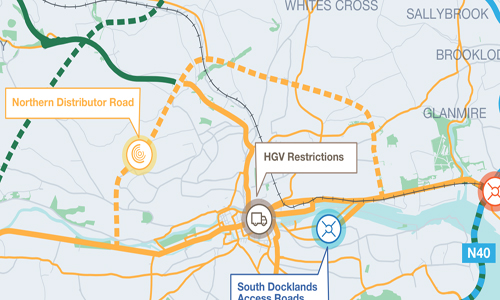
    Cork Northern Distributor Multi Modal Route (formally Cork Northern Distributor Road): from Carrigrohane Road to Tivoli, via Hollyhill/Apple, crossing N20 near the Commons Inn, skirting the NE of the city before joining the R635 at Mayfield and down to the Lower Glanmire Road at Tivoli/Silver Springs. Exact route not decided yet. Will likely be car lane + bus lane in either direction with active travel facilities. At grade signalised junctions.

    Cork City Northern Transport Project (formerly Cork North Ring Road): from Ballincollig to north of Glanmire (Killydonoghue) crossing the N20 south of the Blarney junction. Will be motorway grade with likely only one junction at the crossing point of the N20.

    Since the word "road" has become taboo since 2020 in the name of ministerial placation, it can be hard to distinguish the names of the two projects given that the clear titles on them have been replaced with a set of buzzwords.


  • Registered Users, Registered Users 2 Posts: 3,243 ✭✭✭hans aus dtschl


    Yeah I think both are needed, personally.

    I like your use of the word "multimodal" there Marno, not sure if you came up with that yourself but people don't seem to grasp the core "development facilitator" purpose of a distributor, so throwing "multimodal" into the title fixes a lot of misunderstandings.

    I suggest the other road should be explicitly referred to as "bypass".

    I'd love to see rail corridors evaluated on the bypass corridor since they're tunnelling and flattening gradients. But I just don't think there's room for another load of heavy commuter rail into that side of the city. Just with a massive amount of new density beyond Dublin Hill, Ballyvolane, Upper Glanmire etc, some form of mass transit into the North of the city centre is going to be needed before too long.


  • Registered Users, Registered Users 2 Posts: 598 ✭✭✭DylanQuestion


    I don't see why they don't just go for Cork Northern Distributor and Cork Northern Bypass. This spells out exactly what each road is. One is to distribute people through and around the northside (like the N40 currently does for the southside), and the other is a bypass north of Cork City


  • Registered Users Posts: 453 ✭✭BagofWeed


    Cop and paste from a previous post I wrote on the NDR ...

    I'm all for the distributor and the NNR but both should have been done before the increase in nimbyism and anti car rhetoric. The distributor will have several flash points for nimbyism: the veer off from the existing nrr over to the Banduff and Rathcooney Roads/ Banduff House expect opposition from residents, westbound from the Kinvara Link Road goes through fields near Murphy's Rock and already this year there has been calls to put a development ban there Locals calling on EU to designate Murphy's Rock an Special Area of Conservation (echolive.ie), Sweeneys Hill the people of Rathpeacon won't be happy that both NRR and the distributor will be cutting through their community in the case of the NRR it will be below An Bothar Dearg, the section from the Blarney Rd, Hollyhill towards and over the Lee also will get some environmentalists upset too especially as the NRR would also require a bridge further west along the Lee.

    I don't think there ever will be an NDR sadly.


  • Registered Users, Registered Users 2 Posts: 3,243 ✭✭✭hans aus dtschl


    I think there will. Remember that a distributor can be very well "greenwashed" (I mean this in the positive sense!).

    The bypass is the one I fear will struggle


  • Registered Users, Registered Users 2 Posts: 5,967 ✭✭✭Chris_5339762


    IF the northern distributor gets built, it will be overloaded from Day 1 as it will become a Cork north bypass in a sense (carefully choosing words here so as not to confuse).


    The Cork North Ring will then not be built.


  • Registered Users, Registered Users 2 Posts: 3,243 ✭✭✭hans aus dtschl


    This is my fear exactly. A distributor double-jobbing as a bypass will be bad for everyone.


  • Registered Users, Registered Users 2 Posts: 1,622 ✭✭✭Hibernicis


    Which would leave the North Side asymmetrically symmetrical with the South Side which has a bypass double jobbing as a distributor.


  • Advertisement
  • Moderators, Entertainment Moderators, Science, Health & Environment Moderators Posts: 14,463 Mod ✭✭✭✭marno21


    Yes but at least the south side has a double jobber that has the capacity to do both. If the N40 had at grade signal controlled junctions it wouldn't function much as a bypas.s


  • Registered Users, Registered Users 2 Posts: 598 ✭✭✭DylanQuestion


    Off topic but - we’re very lucky they decided to do a Douglas overpass when they built the N40 originally rather than a roundabout like Kinsale Road/Bandon Road/Sarsfield Road. The traffic at that junction would be even worse than it is today

    Post edited by DylanQuestion on


  • Registered Users, Registered Users 2 Posts: 4,561 ✭✭✭AugustusMinimus


    I think it was misfortunate to eastward entry slips on both roads. Complete mistake.


  • Registered Users, Registered Users 2 Posts: 3,243 ✭✭✭hans aus dtschl


    Agreed on all previous posts. I fear the distributor might well be immediately unfit for purpose as the current north ring road will be the desire line with all of it's associated problems.

    There's also room there to do a more direct sustainable transport route from the east of the Banduff road, over the old dump, down through the Glen but I believe local people are dead against putting any route - even just bicycles - through the Glen River park so It likely won't happen.


  • Registered Users, Registered Users 2 Posts: 598 ✭✭✭DylanQuestion


    What are the plans for the current North Ring Road once the distributor and/or bypass are built? What’s wrong with building the bypass and using the existing North Ring Road as the distributor? It would need some upgrading at certain locations, like the junction with Old Youghal Road and Ballyvolane Road, but it’s probably good enough as is to serve the purpose for at least the north east of the city?


  • Moderators, Entertainment Moderators, Science, Health & Environment Moderators Posts: 14,463 Mod ✭✭✭✭marno21


    It would appear from the indicative routing that the existing R635 from where it turns 90 degrees near Banduff Road to Silver Springs. The NDR is more of a requirement west of the N20 due to the complete lack of routes west of the N20.

    As of right now, if the NDR is built without the NRR it'll be overloaded from day 1 because it'll concentrate a lot of traffic currently using a variety of different routes to navigate the northside.

    The NRR is also currently suspended because of the current Minister's personal preferences.


  • Registered Users, Registered Users 2 Posts: 3,243 ✭✭✭hans aus dtschl


    There's an additional detail here Marno, there is a desire to open development lands to the North East of the city, between Ballyvolane and Upper Glanmire.


  • Registered Users, Registered Users 2 Posts: 598 ✭✭✭DylanQuestion


    I think the council should retain the existing green border around the city (Cork Ring Forest?), i.e. east of Mayfield/Rocehstown, west of Bishopstown, north of Blackpool/Ballyvollane/Knocknahenney and south of the airport. There’s enough existing land within the existing built up city area to build on, especially in the city centre


  • Registered Users, Registered Users 2 Posts: 3,243 ✭✭✭hans aus dtschl


    Nice idea. I wish I'd thought of that in the local area development plan submissions


  • Advertisement
  • Moderators, Entertainment Moderators, Science, Health & Environment Moderators Posts: 14,463 Mod ✭✭✭✭marno21


    Of course there is. That may help provide density along that R614 corridor though which would give frequent buses more viability.


Advertisement