Advertisement
If you have a new account but are having problems posting or verifying your account, please email us on hello@boards.ie for help. Thanks :)
Hello all! Please ensure that you are posting a new thread or question in the appropriate forum. The Feedback forum is overwhelmed with questions that are having to be moved elsewhere. If you need help to verify your account contact hello@boards.ie
Hi there,
There is an issue with role permissions that is being worked on at the moment.
If you are having trouble with access or permissions on regional forums please post here to get access: https://www.boards.ie/discussion/2058365403/you-do-not-have-permission-for-that#latest

Interesting Maps

178101213175

Comments

  • Registered Users, Registered Users 2 Posts: 33,761 ✭✭✭✭RobertKK


    greenttc wrote: »
    That's an interesting map, I had never really thought about how diverse the population of the Titanic was, there were people from almost every continent on that boat. There is some suspicious placing of the markers though, they have marked Limerick and Mayo passengers in some spots that are definitely not Limerick or Mayo :P

    There is a Mayo in the south east, a townsland I think. Not sure which county as its somewhere around the Kilkenny/Laois/Carlow border.


  • Registered Users, Registered Users 2 Posts: 25,420 ✭✭✭✭sligojoek


    Type any town or city in here

    https://anvaka.github.io/city-roads/?


  • Registered Users, Registered Users 2 Posts: 2,664 ✭✭✭Doyler92


    Zaph wrote: »
    The Bann

    No need to Bann him for asking a question?


  • Registered Users, Registered Users 2 Posts: 829 ✭✭✭hognef


    We are one of the warmest places in Europe

    Warmest in the winter and coldest in the summer...


  • Closed Accounts Posts: 2,779 ✭✭✭1o059k7ewrqj3n


    https://nuclearsecrecy.com/nukemap/

    You can see what the effects of an atomic weapon attack would be on any town or city.


  • Advertisement
  • Moderators, Social & Fun Moderators Posts: 13,122 Mod ✭✭✭✭JupiterKid


    Tomorrow (January 27th 2020) marks the 75th Anniversary of the Allied liberation of Auschwitz.

    This map marks the origin of the victims murdered in the Auschwitz death camp by the Nazis between 1942 and 1945. EDIT: apologies for the lack of a legend/key, for some reason it didn’t copy.

    20200125_GDC200_Map-Artboard_6.png


  • Registered Users, Registered Users 2 Posts: 1,881 ✭✭✭dball


    Not a map but def map related,
    I thought about signing up to this but decided the 3 free games every 24 hours was enough,
    Great concept and lots of you tube competition and discussions online.
    https://geoguessr.com/maps/new


  • Registered Users, Registered Users 2 Posts: 1,989 ✭✭✭Noo


    I'm not one for sharing these links but there are some great ones in here. Mainly US based but still interesting.

    https://www.pupperish.com/interesting-maps

    PS Love the thread!! I could spead hours just staring at maps, so glad I'm not alone.


  • Registered Users, Registered Users 2 Posts: 14,016 ✭✭✭✭Deja Boo


    Fascinating interactive weather pattern map of the world from Windy.com... if you type in a location, it provides detailed data... to the right you can click on rain, waves, wind, clouds, temps, etc.


  • Registered Users, Registered Users 2 Posts: 182 ✭✭Philipx


    JupiterKid wrote: »
    Tomorrow (January 27th 2020) marks the 75th Anniversary of the Allied liberation of Auschwitz.

    This map marks the origin of the victims murdered in the Auschwitz death camp by the Nazis between 1942 and 1945. EDIT: apologies for the lack of a legend/key, for some reason it didn’t copy.

    20200125_GDC200_Map-Artboard_6.png

    The scale of it is just mind boggling :(

    It's curious to see locations in the UK marked; I know the Jersey Islands were occupied and people sent from there, but not the mainland.


  • Advertisement
  • Registered Users, Registered Users 2 Posts: 1,166 ✭✭✭lottpaul


    Philipx wrote: »
    I know the Jersey Islands were occupied and people sent from there, but not the mainland.


    The map gives the "origin" of people sent to the camp - presumably place of birth. Families might have moved before the war or could have been visiting etc. That would also explain why there are markers in Sweden, Portugal, Switzerland and other neutral countries too.


  • Registered Users, Registered Users 2 Posts: 5,942 ✭✭✭topper75


    We are one of the warmest least cold places in Europe
    FYP


  • Registered Users, Registered Users 2 Posts: 3,724 ✭✭✭seenitall


    Projected population change for Europe up to 2050.

    Looks kinda scary to me, as someone living in Ireland and having not too much faith in the politicians here being able to manage that huge population change efficiently. Basically, Ireland seems to have a very big attraction factor for the populations across Europe and beyond... the future looks eh interesting.

    https://i0.wp.com/factsmaps.com/wp-content/uploads/2017/11/projected-population-change-european-countries-2017-2050.png


  • Registered Users, Registered Users 2 Posts: 4,508 ✭✭✭KevRossi


    We are one of the warmest places in Europe
    hognef wrote: »
    Warmest in the winter and coldest in the summer...

    We also are country with the 2nd lowest 'highest' temeprature ever recorded on earth. Our highest ever temperature was 33.3C, recorded in 1887, on what was possibly faulty equipment. Only Iceland has ever recorded a lower higher temperature; 30.5C in 1993.


  • Registered Users, Registered Users 2 Posts: 2,082 ✭✭✭bigtimecharlie


  • Registered Users, Registered Users 2 Posts: 1,465 ✭✭✭Anesthetize


    seenitall wrote: »
    Projected population change for Europe up to 2050.

    Looks kinda scary to me, as someone living in Ireland and having not too much faith in the politicians here being able to manage that huge population change efficiently. Basically, Ireland seems to have a very big attraction factor for the populations across Europe and beyond... the future looks eh interesting.

    https://i0.wp.com/factsmaps.com/wp-content/uploads/2017/11/projected-population-change-european-countries-2017-2050.png
    In 2030 the Catholic church regains its grip on the country, thanks to a very conservative government.

    The church then makes contraception illegal, and Irish families return to consisting of 18 kids.


  • Registered Users, Registered Users 2 Posts: 18,064 ✭✭✭✭Thargor


    Scary reading for the Moldovan government there.


  • Registered Users, Registered Users 2 Posts: 20,558 ✭✭✭✭dreamers75


    Worlds oldest companies *

    https://imgur.com/gallery/N336g3d

    *Fairly impossible to be 100%


  • Registered Users, Registered Users 2 Posts: 1,881 ✭✭✭dball


    m17 wrote: »
    z9gWPce.jpg

    :)


  • Moderators, Social & Fun Moderators Posts: 13,122 Mod ✭✭✭✭JupiterKid


    Daily commuting to work in Manhattan by transport mode in New York City and Metro area.

    lead_large.jpg


  • Advertisement
  • Registered Users, Registered Users 2 Posts: 5,942 ✭✭✭topper75


    In 2030 the Catholic church regains its grip on the country, thanks to a very conservative government.

    The church then makes contraception illegal, and Irish families return to consisting of 18 kids.

    The Ciaráns and Jennifers won't be having them though. Much more so the Dwaynes and the Madisons.


  • Moderators, Politics Moderators Posts: 41,336 Mod ✭✭✭✭Seth Brundle


    \m/
    11243-j4dfi1.jpg


  • Moderators, Politics Moderators Posts: 41,336 Mod ✭✭✭✭Seth Brundle


  • Banned (with Prison Access) Posts: 2,907 ✭✭✭Stevieluvsye


    Seth has just thrown a grenade with that map.


  • Registered Users, Registered Users 2 Posts: 3,724 ✭✭✭seenitall


    \m/
    11243-j4dfi1.jpg

    Hey!! The Lordi thing is finally starting to make sense, 14 years later :D


  • Banned (with Prison Access) Posts: 9,078 ✭✭✭IAMAMORON


    The heavy metal map is the best map I have ever seen, thanks for posting.

    It is worth noting that the last periods off El Nino were in 1982-83, 97-98 and 2014 - 2016. Just saying. This global phenomenon is known to dramatically affect sea temperatures around the globe, including polar regions.


  • Moderators, Politics Moderators Posts: 41,336 Mod ✭✭✭✭Seth Brundle


    IAMAMORON wrote: »
    The heavy metal map is the best map I have ever seen, thanks for posting.
    I'd love to see a map showing the Bay Area thrash bands hometowns


  • Banned (with Prison Access) Posts: 9,078 ✭✭✭IAMAMORON


    I'd love to see a map showing the Bay Area thrash bands hometowns

    I will make it my mission in life, trust me.


  • Registered Users, Registered Users 2 Posts: 22,415 ✭✭✭✭endacl


    I'd love to see a map showing the Bay Area thrash bands hometowns

    Oddly enough, loads of them hail from Dublin!

    https://en.m.wikipedia.org/wiki/Dublin,_California

    Which spawned a supergroup...

    https://en.m.wikipedia.org/wiki/Dublin_Death_Patrol

    :D


  • Advertisement
  • Moderators, Recreation & Hobbies Moderators, Science, Health & Environment Moderators, Technology & Internet Moderators Posts: 93,672 Mod ✭✭✭✭Capt'n Midnight


    xZi1VaB.jpg


  • Moderators, Social & Fun Moderators Posts: 13,122 Mod ✭✭✭✭JupiterKid


    Percentage of workers commuting to Greater London on a daily basis, 2016

    11417_85147113_0f49ff8c-d3f1-422a-88ef-313fc195ec6a.jpeg


  • Registered Users, Registered Users 2 Posts: 40,672 ✭✭✭✭ohnonotgmail


    I really pity the people who commute from lands end and the north west. They must get up before they go to bed.


  • Registered Users, Registered Users 2 Posts: 78,584 ✭✭✭✭Victor


    I really pity the people who commute from lands end and the north west. They must get up before they go to bed.
    Train and airline staff.

    According to the census, there are people who live in Tralee an commute to Dublin. I checked with the CSO and there explanation was there may be people who spend most of the week in Tralee, but then spend a few days in Dublin for work.


  • Registered Users, Registered Users 2 Posts: 5,851 ✭✭✭roosterman71


    Victor wrote: »
    Train and airline staff.

    According to the census, there are people who live in Tralee an commute to Dublin. I checked with the CSO and there explanation was there may be people who spend most of the week in Tralee, but then spend a few days in Dublin for work.

    I know someone who does that. Works from home, but 3 days a month in Dublin. They fly up on a morning, stay in a hotel for 2 nights then fly back in 3rd evening. Cheaper than bus/train!


  • Registered Users, Registered Users 2 Posts: 20,739 ✭✭✭✭El_Duderino 09


    I really pity the people who commute from lands end and the north west. They must get up before they go to bed.

    The 5 areas in the North East are all on the train line. Newcastle, Durham, Darlington, Leeds and York to the right. It's 3 hours from Newcastle to London Kings Cross and only* 2 hours from Leeds.

    *people commute 2 hours from the south of London but they don't travel as far in that time. Fewer would travel the same time from the north.

    My Mrs probably fit into that. Lived in Newcastle and based in London bit actually travelled down on monday morning and back home Tuesday evening. The rest of the week she worked from home.


  • Advertisement
  • Registered Users, Registered Users 2 Posts: 2,869 ✭✭✭PommieBast


    Until they changed the law on what constituted residency for tax purposes, some people's commute involved flying into and out of London from abroad.


  • Moderators, Social & Fun Moderators Posts: 13,122 Mod ✭✭✭✭JupiterKid


    Debt to GDP Ratio of European Countries in 2017

    debt-to-gdp-ratio-european-countries.png


  • Registered Users, Registered Users 2 Posts: 2,092 ✭✭✭The Tetrarch


    Victor wrote: »
    Train and airline staff.
    According to the census, there are people who live in Tralee an commute to Dublin. I checked with the CSO and there explanation was there may be people who spend most of the week in Tralee, but then spend a few days in Dublin for work.
    Healy-Rae x 2 ?


  • Hosted Moderators Posts: 11,362 ✭✭✭✭Scarinae


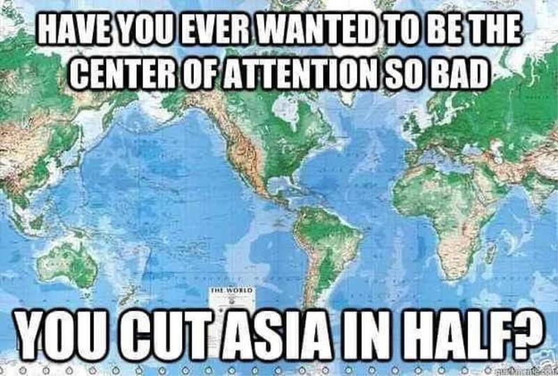
    26bh8t1y8th41.jpg


  • Registered Users, Registered Users 2 Posts: 40,672 ✭✭✭✭ohnonotgmail


    It took me a second to figure out what way that map was orientated.


  • Advertisement
  • Registered Users, Registered Users 2 Posts: 2,213 ✭✭✭MajesticDonkey


    It took me a second to figure out what way that map was orientated.

    Thank you, thought I was the only one!


  • Registered Users, Registered Users 2 Posts: 3,862 ✭✭✭mikhail


    It took me a second to figure out what way that map was orientated.
    It's unusual to have a world map that contains New Zealand but doesn't have Brazil!


  • Registered Users, Registered Users 2 Posts: 14,388 ✭✭✭✭Professor Moriarty


    I must say, this is a great thread.


  • Moderators, Politics Moderators Posts: 41,336 Mod ✭✭✭✭Seth Brundle


    Historic Environment Viewer (Leixlip shown as example)
    503379.JPG


  • Moderators, Politics Moderators Posts: 41,336 Mod ✭✭✭✭Seth Brundle


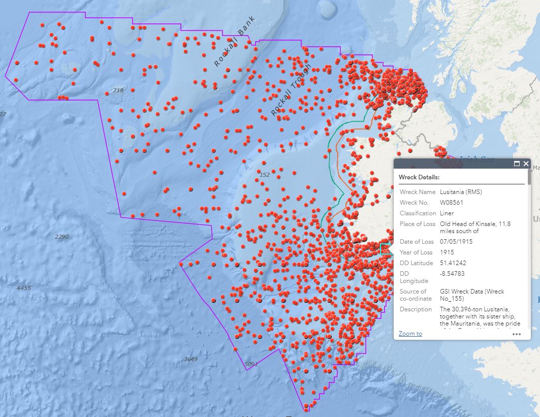
    National Monuments Service: Wreck Viewer
    DbnouXFX4AApWnY?format=jpg&name=medium


  • Registered Users, Registered Users 2 Posts: 22,415 ✭✭✭✭endacl


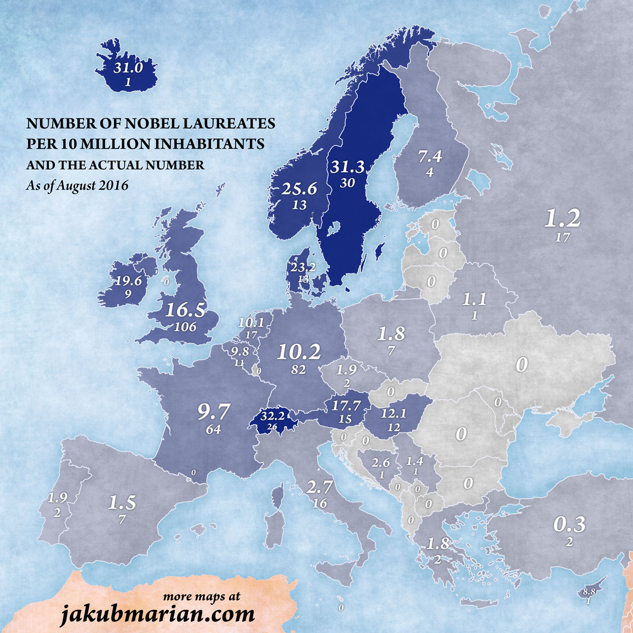
    Nobel Prizes per capita. We’re not doing too badly!

    nobel-laureates.jpg


  • Registered Users, Registered Users 2 Posts: 22,415 ✭✭✭✭endacl


  • Registered Users, Registered Users 2 Posts: 8,045 ✭✭✭Gaspode


  • Registered Users, Registered Users 2 Posts: 1,881 ✭✭✭dball


    https://www.boards.ie/vbulletin/showpost.php?p=112635654&postcount=1545

    Like Fun with Flags?
    Enjoy a good map?

    Seterra.
    Still a great app for PC and Linux but for quite a while there's been an app for Android which has improved over the last while, and shows you (well me at least) how little you know about Maps and not as good with flags as I thought I was.
    Quite addictive when you get going.

    https://play.google.com/store/apps/d...m.seterra.free


  • Moderators, Politics Moderators Posts: 41,336 Mod ✭✭✭✭Seth Brundle


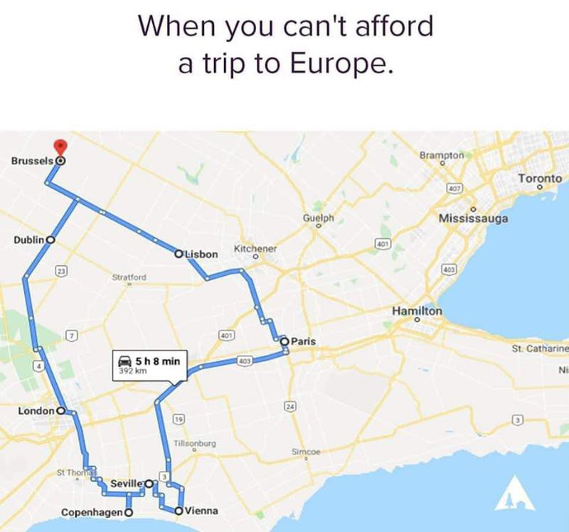
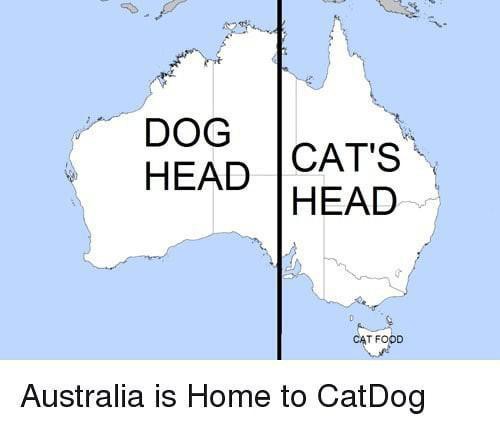
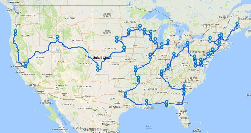
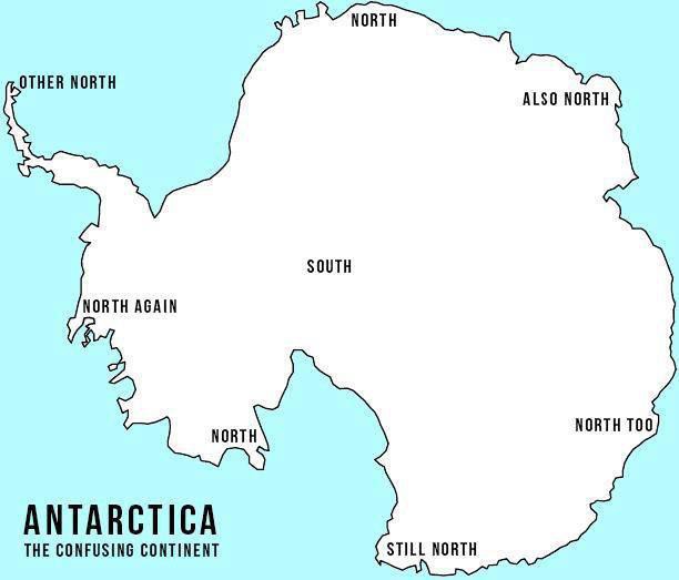
    Just stumbled across this site: Hilarious Terrible Maps

    599f58f663c64f678fec0a07623ddb08.jpeg

    64c55f7a4fe3491899e554818c4e03fa.jpeg

    75a598c14e6f443d925721ed6d9a6f4b.jpeg

    68404323acf64699aeaadc7ffa72ba46.jpeg

    ab6b94279ed2469f95fe5bfa6d943f5c.jpeg

    0bdcebf3fa354fef8b2807e3bdcf3406.png

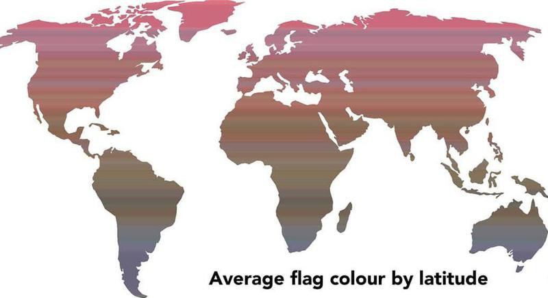
    Time broke down 196 nation flags by color and found that 14.3 percent of flags include red, and 17.7 percent include white.
    It also found yellow in a nation’s flag shows up across five continents, which is why there’s a brown color in the center.
    08100d7ebf964e068c09aa090826988d.jpeg


  • Advertisement
Advertisement